Our series of “How’d they get here?” posts is written to illustrate the nuts and bolts of how our early Mequon pioneers travelled from their original homes or ports of arrival in North America, to the newly opened federal lands in Wisconsin Territory, circa 1830-1850. See Note 1, below, for links to other posts in the series.
Village of Buffalo, 1825
In a previous post, we followed the newly-opened route for westward migrants from the New York City docks, up the Hudson River to Albany, and then along the new Erie Canal towards its terminus at the village of of Buffalo, New York, at the eastern end of Lake Erie. After seven days of travel on canal boats, the westbound traveler of 1825 would have looked up and seen this, the muddy streets and modest harbor of Buffalo:
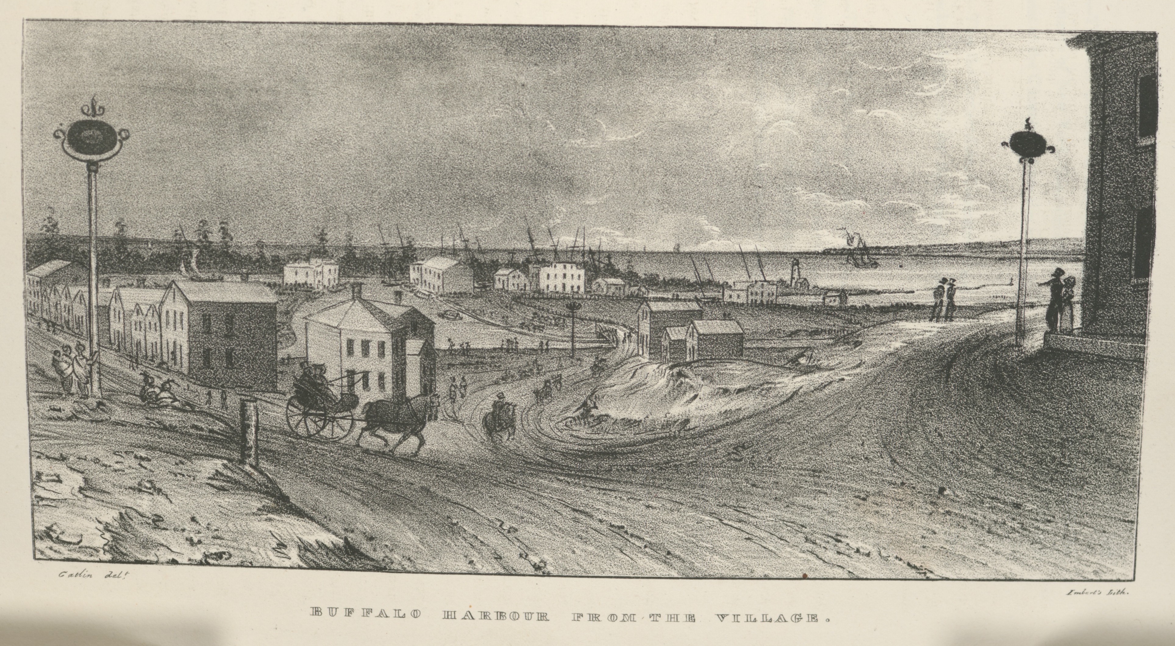
Buffalo Harbour from the Village, in Cadwallader Colden, et. al., Memoir…at the Completion of the New York Canals, New York, 1825. Image from “extra-illustrated” edition in New York Public Library Digital Collections, scanned copy of standard edition of book via GoogleBooks. Public domain. Click to open larger image in new window.
After leaving the Deep Cut above Lockport, the last part of the Erie Canal merges with Tonawanda Creek, seen here flowing into the village from far left to center, in front of the line of distant trees, and then curving toward the viewer before exiting into the harbor, to the right. The original Buffalo lighthouse of 1818 can be see on a small peninsula, right of center, just above where Tonawanda Creek meets the lake.
Continue reading