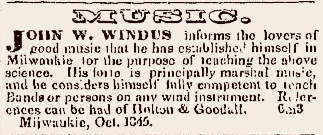
Monday: Map Day! – Lower Canada’s Eastern Townships in 1842

The Search for JMC’s roots continues!1 For the last few months, I’ve spent hour after hour reading through hundreds of digitized pages of the various manuscript land petitions and related documents that form the Land Petitions of Lower Canada, 1764-1841 database at Library and Archives of Canada (LAC).2

The good news is that I have found a lot of information about various early Clark (or Clarke) surname immigrants that petitioned for land—and actually settled on it—in Lower Canada during the relevant years of circa 1791-1840. Many of the documents that I’ve found contain information about these Clark immigrants, their families, and from whence they come. This is important, as we need to sort the Patriot, Vermont-related Clark families from other Clark immigrants from New York and New England (including American Loyalists), and the various Anglo-Canadian Clark families that sought land in the Eastern Townships at the same time. So, you know what that means…

We need another map!

Now that we have all this data, we need a way to organize and present it. And since so many of our rejected candidates earn their “Nope, not our Clark family” status because they settled far away from Stanstead, I thought it was time to make a big map of where these various Clark petitioners for Lower Canada land actually ended up. Then, in theory, we can eliminate the Clark families that settled “too far” from Stanstead (and adjacent Derby, Vermont), and focus on the Clarks that settled in or near Stanstead itself.

It’s going to take a while to assemble and present all the data. So we need a big, easy to read map created around the time of Jonathan Clark’s childhood and/or youth, from about 1812 until his arrival in New York state in 1831. (The latter date is flexible, as long as we find a map that predates the reorganization of the townships into larger counties in 1847.) We’ve presented some great Lower Canada maps here at CHH but, as is typical of that era, if they are accurate and detailed, they also tend to be visually “busy” and hard to read. But, dear readers, I finally found just the thing…

Continue reading

JMC: The missing years, 1836-1839

I’m still on the search for Jonathan M. Clark’s parents and other kin somewhere in the early-19th-century wilderness of northern Vermont and southern Québec. I hope to publish more about that here in the near future.

As part of that project, I’ve spent quite a bit of time over the past few months organizing and re-examining the many research materials that I’ve gathered about JMC and his world, and I’ve constructed a whole bunch of genealogies for early Vermont, New Hampshire, and Lower Canada families named Clark that turn out—alas!—not to be related to our Jonathan M. Clark.

More mysteries…

Along with the mystery of JMC’s still-unknown family and childhood, Clark House museum director Nina Look and I have been trying to chase down some rumors that suggest Jonathan Clark may have spent his three years between mustering out of the U.S. Army (in 1836), and purchasing land at the land office in Milwaukee (in late 1839), as a surveyor in or near the area around Fort Winnebago, Columbia County, Wisconsin Territory. At the moment, that story remains a mystery, too. I’ll let you know if we find out more.

Anyway, with all these facts, rumors and mysteries—and many, many others—rolling around in my head, I thought it might be useful to outline JMC’s life in a handy, chronological timeline. Here’s a draft of that timeline, including what we do—and don’t—know about Jonathan M. Clark’s whereabouts and activities during his lifetime, as of July 1, 2024. I’ve included links to some relevant Clark House Historian posts where possible; please click on them for more information.

Childhood & Youth

November 28, 1812, (possibly, 1811) born to unknown parents, in or near Derby, VT, or Stanstead, Lower Canada

• Late-1812 to early-1831: JMC’s childhood whereabouts and activities unknown for 18+ years, with one possible exception:

Continue reading

How do you…? A Clark-era handbook

Recently, reader and Jonathan Clark House friend Ed Foster mentioned that he wanted to know more about how various JCH tools were used and necessary supplies were made, for example, how were lye soap or candles made? These are excellent questions, as they help us understand the day-to-day world of the Clarks and their neighbors in a more vivid and detailed way.

So, how did Jonathan and Mary Clark make candles or soap or perform many of the other home- and farm-related tasks that occupied so much of their time? Living in their pre-internet, pre-YouTube era, if they did not learn these skills from a parent or other mentor, how did they master such skills on their own? Fortunately for them, the 19th-century was a golden era of what we would call “How To” books.

The “Endless Variety” of books, circa 1837

Jonathan M. Clark mustered out of the U.S. Army at the end of his three-year’s service with Co. K, 5th Regiment Infantry, in September, 1836. While in service, he may have learned or refined a number of useful skills, especially those related to surveying and road construction. The army thought highly enough of his character and aptitude that he rose from private soldier in September, 1833, to Sergeant in 1836. He was, by several accounts, an intelligent and well-read man.

But even an intelligent, experienced man can’t know everything. For that, there were books and stores that sold them. If Jonathan, after he left the army, needed more information on the “practical arts,” he could stop by a shop such as White & Gallup’s “Variety Store” in Green Bay, and probably find the information he needed:

“Books,” advertisement from the [Green Bay] Wisconsin Democrat, 13 Jan 1838, page 1. First published 12 Dec 1837.

One of these advertised volumes caught my eye, just like it may have attracted the eye of Jonathan Clark and many other settlers in the wilds of the Wisconsin Territory in the 1830s…

Continue reading

Memorial Day, 2024

Lest We Forget

Our annual Memorial Day post, first published in 2020. Updated for 2024 with new information about the Civil War service of Isham and Emily (Bigelow) Day’s eldest child, Cpl. James Lemon Day (1834-1863).

Graves of Unknown Union Soldiers, Memphis National Cemetery, photo by Clayton B. Fraser, (Library of Congress), public domain. Memphis National Cemetery is the final resting place of Mequon’s Watson Peter Woodworth, and almost 14,000 of his Union Army comrades.

Today is the day our nation officially observes Memorial Day. For many Americans, Memorial Day represents “the first day of summer,” and is traditionally celebrated with trips to the lake, picnics, parades, and sales on cars, appliances, and other consumer goods.

But for many of us, Memorial Day remains rooted in its origins as Decoration Day. The first national observance was in 1868, when retired general John A. Logan, commander and chief of the Grand Army of the Republic—the Union veterans’ organization—issued his General Order Number 11, designating May 30 as a memorial day “for the purpose of strewing with flowers or otherwise decorating the graves of comrades who died in defense of their country during the late rebellion, and whose bodies now lie in almost every city, village, and hamlet churchyard in the land.”

On this Memorial Day, let’s take a moment to remember what this day truly represents.

Continue reading

The farm garden

It’s already the second week of May, 2024, and summertime will soon be here. At our southeastern Wisconsin home the first spring flowers are done, and the next round of blossoms have been blooming for a week or two. The peas will soon be in the ground, and we already harvested enough rhubarb to make two and a half small jars of jam. The tomato and pepper seedlings and the squashes will go in soon, and I need to put up a trellis or two so we can start the big patch of green beans. So even though it’s “early” by the standards of previous years, we’ve got gardening on the mind here at the Historian’s house, and I thought you might enjoy a slightly-belated repost of this annual favorite, which first appeared here in April, 2021. Cheers!

Planning the garden

It’s early April, and the growing season is not far off. For a farmer like Jonathan M. Clark, it’s a little early yet for plowing and sowing, but not too early to make plans and sharpen the tools. For a farmer’s wife, like Mary (Turck) Clark, it’s not too soon to think about the farm garden, its crops and layout.

Garden at the Turck-Schottler House, 1870s Hessian Immigrant Farm, Old World Wisconsin. Photo credit Reed Perkins, 2022.1

I don’t know if Mary and Jonathan were regular readers of the popular and affordable farmers’ almanacs of their era; I wouldn’t be surprised if they were. There were many to chose from. Perhaps they had a copy of something like:

Continue reading

Clark House News – May, 2024

The JCHM Newsletter is here!

The Spring edition of the Jonathan Clark House Museum newsletter is here! It’s filled with Clark House news and updates, notices of upcoming events, and recaps and photos of a variety of JCH happenings since last November. There’s also a “Meet the Historian” article on page 7, in which I discuss how I got involved with the museum and what I do as Clark House historian. I hope you find it interesting.

Click the image (below) to view and/or download your own PDF copy of the complete Spring | May 2024 newsletter.

You can also view the May newsletter at the Jonathan Clark House Museum website. Just click this link.

Adventures in Graphic Design…

As I mentioned in an earlier post, I recently signed on as the part-time graphic designer for the Jonathan Clark House Museum newsletter, posters, and other visual products. I will continue my independent, volunteer, Clark House Historian research and blog posting, but I’ll also help prepare various JCH publications, using the design and layout skills that I’ve developed over the decades, including more than 400 illustrated blog posts here at CHH. And speaking of graphic design…

Continue reading

Lost in the underbrush…

Advertisement, “Choppers Wanted,” Milwaukee Sentinel, August 27, 1839, page 3.

After years of searching for original reports and drawings or photographs of early Wisconsin road construction, I find myself entangled among piles of information and images on just that topic. Now, the challenge is to organize the best of this material into a few CHH blog posts and wrap up—for now—our most recent excursion along Wisconsin’s earliest roads.1

Like contractor George E. Graves in Sauk Harbor [Port Washington] in 1834 (above), I could probably use the assistance of some (digital) “axe-men” to clear my way forward. Perhaps some hearty fellows such as these…

Continue reading

The Green Bay-to-Chicago and other federal roads, c. 1840

Time for one more follow-up to our recent posts Monday: Map Day! – Wisconsin’s Federal Roads in 1840 and JMC, the Army, and the Military Road, 1835-1840. As I mentioned in that “Monday: Map Day!” post, I recently found some unique maps and related documents in the digitized collections of the National Archives and Records Administration (NARA), in particular a group of maps and drawings created in 1840 by members of the army’s Corps of Topographical Engineers under the supervision of Capt. T. J. Cram.

Before they get lost in my files, I thought I’d share the other documents from Capt. Cram’s 1840 survey that have survived and been digitized by NARA. I’ve already said quite a bit about these 1840 maps and drawings; now I’m most interested in gathering the remaining 1840 documents and their bibliographic citations here for reference. So not much commentary today, but lots of images. And—as always—I recommend clicking on each item to open a larger, higher-resolution image in a new window.

Bridges on the Green Bay Road

The first item is of particular interest for Clark House history fans, as it provides additional details about old Washington/Ozaukee county’s first federal road, the north-south route connecting Fort Dearborn, Chicago, to Fort Howard at Green Bay. The drawing is part of a larger document; this portion is titled “Road from Ft. Howard, by Milwaukee & Racine, to the Northern boundary of Illinois.”

NARA, full citation, below.

The drawing illustrates construction details of the simple wooden bridges that were part of the Green Bay Road, circa 1840. This road, and these bridges, comprised the main north-south transportation route for the U.S. Mail and for immigrants and settlers of the new counties of southeast Wisconsin Territory. The Clarks, Turcks, Bonniwells and other early Mequon pioneers would have crossed bridges like these on their trips to and from Milwaukee, Grafton, Port Washington and beyond on the Green Bay Road.

And that’s not all…

Continue reading

JMC, the Army, and the Military Road, 1835-1840

Today’s post is a follow-up to our recent Monday: Map Day! – Wisconsin’s Federal Roads in 1840. It features another document created by the U.S. Army’s Corps of Topographical Engineers and preserved in the collections of the National Archives and Records Administration. Today’s drawing interests us as it documents—in some detail—the kind of road building work that Pvt. (later Sgt.) Jonathan M. Clark performed as a member of Company K, 5th Regiment, U.S. Infantry.

Webster, Jos. D, et. al., “Military Road from Fort Crawford to Fort Winnebago to Fort Howard (Wisconsin),” NARA, Record Group 77: Records of the Office of the Chief of Engineers, Series: Civil Works Map File, File Unit: United States, accessed here, April 14, 2024.

This document interests us because after JMC left the army he, with many of his early Mequon neighbors, spent a good part of the 1840s surveying, cutting, clearing, and grubbing out some of old Washington/Ozaukee county’s earliest roads. In the process, these pioneers had to bridge streams and rivers of various sizes and depths, and find ways to keep the unpaved roadway dry and firm. How did they do it with the limited supplies and tools at hand?

Today’s document shows how the U.S. Army solved some of those issues a bit farther north, on Wisconsin’s east-west Military Road. The techniques and approaches to road construction use there may have influenced how JMC and our early county road builders solved the problems of building roads in the forests, wetlands, and open prairies of 1840s Washington county.

Continue reading

Monday: Map Day! – Wisconsin’s Federal Roads in 1840

I spent much of January and February preparing my March 9th, 2024, Civil War presentation at the Cedarburg History Museum. In that talk I tried to take a more personal and local look at the war by examining the military service of few of the Cedarburg relatives and future in-laws of 1868-1873 Clark House resident Fred Beckmann. In my research, I found some unique stories of their years of Union service in the 9th and 26th Wisconsin Infantry Regiments, as well as the impact of the war on families and friends back home in Wisconsin.

I also found several new online collections of unique maps and historical documents. Today’s map is from one of those online sources, the digitized map collection of the National Archives and Records Administration (more on NARA and its holdings, below). This map was made 20 years before the Civil War, in September, 1840, and is one of the earliest—if not the earliest—maps of the federal roads in Wisconsin Territory.1

U.S. Roads in Wisconsin Territory, 1840

Continue reading