Census Records for the In-Between Years: 1838

UPDATED, July 24, 2021 with another spelling and additional info on early settler S. McEvony-McEvery-McEvany.

The Second Wisconsin Territorial Census

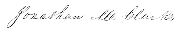
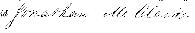
The second Wisconsin territorial census, taken in 1838, is the only Wisconsin territorial census we have not yet discussed here at Clark House Historian. If you need to catch up, at the end of this post is a list of our previous discussions of Jonathan Clark, Mary Turck, and their family on the federal, territorial and state censuses enumerated between 1836 to 1855.

By early 1838, several new counties—Dodge, Jefferson and Washington—had been created from the original, larger, Milwaukee and Brown counties, although the new counties were still “attached” to Milwaukee county for judicial purposes.1 This means that the 1838 territorial census of the newly-created Jefferson, Dodge and Washington counties was the responsibility of the Milwaukee county enumerator, Sheriff Own (sic) Aldrich.

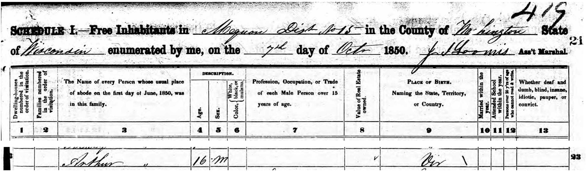
The filmed images for the second Wisconsin territorial census, enumerated in 1838, are available online as FHL film no.1,293,919 , aka DGS film 7,897,817 (Item 2, following the 1836 census. The 1838 census begins at image 118 of 532). Here’s the first page of the Milwaukee county census (including the attached counties of Jefferson, Dodge and Washington):

Continue reading

Monday: Map Day! – Mequon’s First Survey, 1836-1837

I love maps, all kinds of maps. I especially like comparing various maps of the same area as it changes over time. I have collected a number of maps that illuminate various aspects of Clark family and Clark House history, and I thought I’d start posting some for you all to use and enjoy.

Fortunately, we are in a digital golden age of historical maps, many available for free download and use. Among the best sites are the online map collections at the Library of Congress and the New York Public Library. Take some time to click the links and browse.

But today’s map comes from another source, the Bureau of Land Management’s General Land Office website. Previously, we discussed the BLM/GLO as the go-to site for land patent indexes with exact descriptions and images of government land patents issued in the 30 Public Lands States. Click the link to start at the BLM/GLO homepage, then click on “Survey Search.” That will take you to this page:

Notice how “Surveys” is highlighted in black text in the left side column. For a sample search, I’ve entered “Wisconsin” as a state, and the exact town and range numbers for the Town of Mequon (T9N-R21E). Click the orange “Search Surveys” button, and you’ll get this results page:

Continue reading

Census Records for the In-Between Years: 1847

The final territorial census, with a few notes on changing township names & boundaries in old Washington County

Wisconsin officially enumerated its final territorial census on December 1, 1847. Six short months later, on May 30, 1848, Wisconsin was admitted to the Union as the 30th state. The individual schedules for Wisconsin’s 1847 territorial census still exist for most counties. Unfortunately, the schedules for old Washington county are not among them.

The surviving schedules of the 1847 Wisconsin territorial census are available for researchers on two microfilms:

The first of the two 1847 census microfilms has not yet been digitized. So if you’d like to view the 1847 census schedules—for, say, Brown or Milwaukee counties—you will need to wait until the Wisconsin Historical Society library and archives in Madison are once again open for business. Or, if you live in Wisconsin, you should be able to request and view WHS microfilms at your local library or nearby Wisconsin Historical Society Area Research Center, once they are up and running again.

All that remains of the 1847 Washington county census is this page with the official tally for each category in each district:

Continue reading

Census Records for the In-Between Years: 1846

Our previous Clark House Historian post was an introduction to the Wisconsin territorial and state censuses, with a close look and complete images of Washington county’s pages from the 1842 census. If you missed that, or need a refresher on how to navigate the FamilySearch.org collection of (free!) census images, please read Part 1, here.

The focus of today’s post is the next Wisconsin territorial census, officially enumerated on June 1, 1846. It is available as FHL film number 1,293,920, aka DGS film number 8,117,163. Click one of the film numbers to navigate to the 1846 census images. The Washington county census page images begin on image number 922 of 1103

For this census, Washington county was divided into two districts, each with its own enumerator. Patrick Toland was the enumerator for District No. 1, the western division, consisting of the towns of Erin, Richfield, Germantown, Wright, Polk, Jackson, Addison and West Bend. His summary of the enumeration was placed at the front of the census folder (images 923-925). The essential results for District No. 1 are here, image 924 of 1103:

Continue reading

Census Records for the In-Between Years: 1842

Don’t Forget the (Free!) Territorial and State Censuses

Although they are not as informative as the decennial federal censuses, Wisconsin’s territorial and state census returns can offer useful information about the growth and development of places—such as Mequon—and can add to what we know about a family—like the Clarks—and their neighbors at various times between the once-a-decade federal census population schedules. For a nice explanation and overview of federal, territorial and state census history in Wisconsin, please go to the Wisconsin census FamilySearch.org wiki page. This is an invaluable first stop for locating these records. Be sure to peruse the lists of which records have been preserved for which counties; not all census records have survived. And the Wisconsin Historical Society has a similar page of useful Census Research Tips

The FamilySearch.org Wiki page is kept pretty current, but there have been a few changes that may not be reflected there yet. In one positive development (especially for the safer-at-home researcher), it appears that all of the microfilmed state and territorial censuses are now viewable—at no cost—via the FamilySearch.org portal. (Note that you will have to use a free account to be able to view the digitized images online. So create an account if you don’t already have one, and login before you search the indexes and click the links for the multitude of digitized microfilms.)

Here are some links and tips to speed your search. For the FamilySearch.org index, click here: United States, Wisconsin online census collections. You should land on a page that looks like this:

Continue reading

The “E” is silent – as in “Clarke”

A “New” Jonathan M. Clark Document, a New Line of Inquiry, and a Friendly Reminder…

Take a look at the following name as written by a professional U.S. land office clerk in three different places on land patent no. 19687, from 1848:

Patent No. 19687, Jonathan M. Clark(e)? #1
Patent No. 19687, Jonathan M. Clark(e)? #2
Patent No. 19687, Jonathan M. Clark(e)? #3

What to you think? Jonathan M. Clark or Clarke? Is that a silent “e” at the end of “Clark,” or just a looping flourish? Whoever indexed this document at the Bureau of Land Management’s General Land Office website1 thought it was Clarke. Is it a big deal? No. Given that the GLO has been digitizing and indexing hundreds of thousands of pages of maps, survey notes and patent documents for the last decade or two, we can’t expect that the indexers can cross-reference each name on each patent and check for consistent spelling. And besides, 19th-century spelling is notoriously capricious anyway.

On the other hand, maybe the indexer could have looked at the end of the document and compared the “K” in “Clark” to the “K” at the end of this signature, representing our eleventh President:

Continue reading

History Mystery! No. 4 – Who was Arthur Clark?

And what can he tell us about Jonathan’s Vermont (or Lower Canada) roots?

We’ve spent a lot of time looking at the Clark family on the 1850 federal census, and using that document to tease out as much information as possible about Jonathan, Mary, their children and their life in Mequon, circa 1850. If you missed the earlier posts, you can catch up here, here, here, and here. Yet after all that, we are still left with one intriguing question from that census: Who was Arthur Clark?

To date, the only source that connects any “Arthur Clark” to the Jonathan Clark family is line 23 of this page of the 1850 census. What do we find there?

Arthur Clark on 1850 U.S. Federal Census, Mequon Dist. 15, Washington Co., Wisconsin (detail of header and line 23) Click to open larger image in a new window.
Continue reading

The Clark Family in 1850 – part 4

Beyond Names, Dates & Birthplaces

Previously—and, yes, it’s been a while—we looked at the Jonathan Clark family as enumerated on the population schedule of the 1850 U. S. Federal Census. If you missed those posts, here are the links for Part 1, Part 2 and Part 3. Take a look at those, and you’ll learn some key facts about the Clarks: the names and ages of each person in the household, and where each was born. That’s important information, but not all. In 1850, the census bureau wanted to know more, and if we look carefully we can discover some interesting things about the family:

Continue reading

Think Like a Historian…

To all my blog readers, I hope this finds you well and staying safe at home.

I just received a message from Jonathan Clark House director Nina Look and I thought I’d share it with you:

Dear Friends-

As you might imagine, the Clark House is closed at this time, but we continue to think about the history of our early settlers and how important it is to share that history with our children. I prepared the attached guide with the help of JCH Education Coordinator Margaret Bussone and JCH Curator Fred Derr.

Feel free to pass it on to a young person who may want to “Think like a historian.”

Nina Look, Director

CLARK HOUSE Think Like a Historian image

Click this link to open the CLARK HOUSE Guide for Young Visitors

Continue reading

O!…Canada? History Mystery! No. 3

Jonathan M. Clark was born…where?

Perhaps this should really be the Number One Clark House History Mystery! — was Jonathan M. Clark born in the United States or not? All of our previous evidence indicates that Jonathan M. Clark was born in Vermont in 1811 or 1812, namely: 

• Jonathan’s army enlistment papers from September 19, 1833, state that he was “…born in Derby, in the State of Vermont.”

• His 1850 Federal Census population schedule declares he was born in “Vir,” which we are quite certain indicates the State of Vermont.

• In later years, JMC’s children would almost always declare on subsequent Federal Censuses that their father was born in Vermont. (There were a few exceptions; “Ohio” was given by one daughter almost a half-century after her father’s death. We’ll have more on those census responses in later posts.) For example, the second sentence of daughter Caroline Clark Woodward’s biography in American Women: Fifteen Hundred Biographies With Over 1,400 Portraits… (New York: Mast, Crowell & Kirkpatrick, 1897, page 799) reads: Her father, Jonathan M. Clark, was a Vermonter of English descent, who, born in 1812 , of Revolutionary parentage, inherited an intense American patriotism.

So it seems clear that Jonathan M. Clark was born in Vermont. If that’s the case why, on March 19, 1848, did JMC travel to the District Court of the United States in Milwaukee County, Wisconsin Territory and file this document?:

Continue reading