UPDATED, Oct. 4, 2021, with a few minor edits and to add an additional footnote.
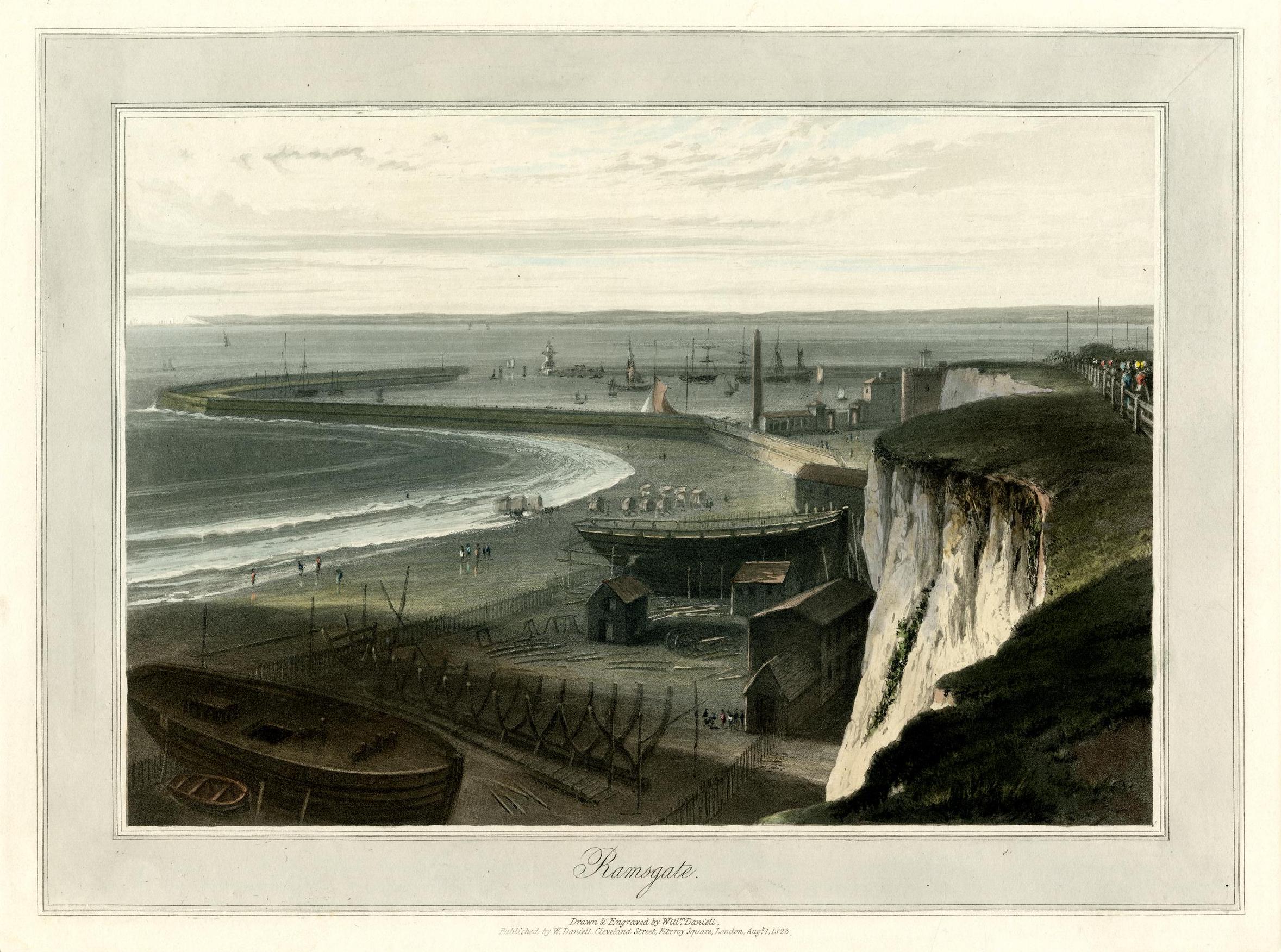
I’m still working on some longer posts; they should be ready soon. Meanwhile, I thought you might enjoy two lovely images, beginning with this nineteenth-century print, a view that would have been very familiar to a surprising number of our early Mequon immigrants:
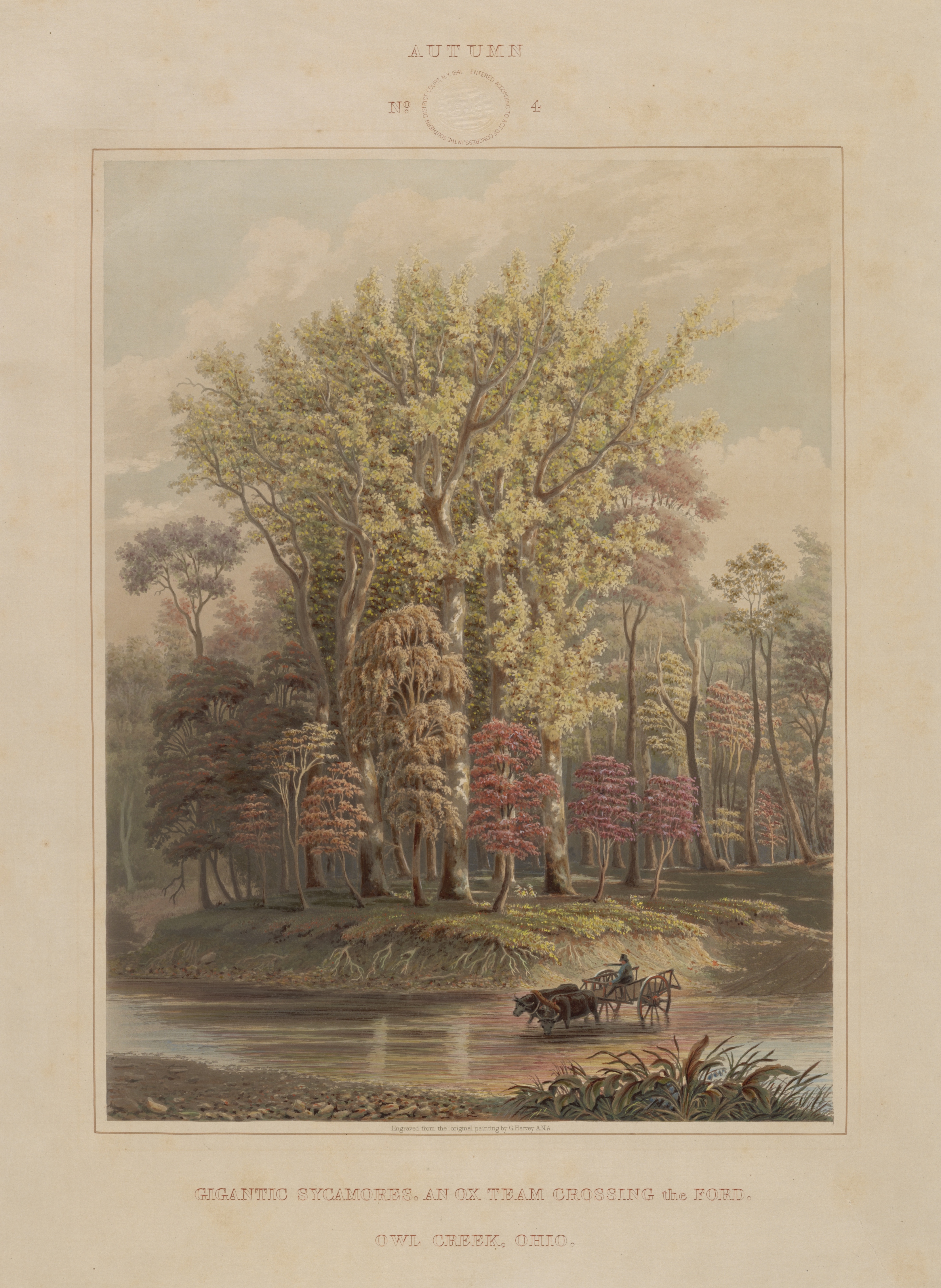
These days—living and working inside our climate controlled, electrically illuminated spaces—it’s easy to miss nature’s seasonal changes. But you can be sure that our early Clark House residents, friends, and neighbors didn’t miss the start of autumn. Rural life was—and is—centered around the progression of the seasons, and autumn brought new farm and household chores to suit the changing weather and decreasing daylight.
So pile up your haystacks, sharpen and oil your tools before you store them in the barn, fill up the root cellar with food for the next six months or more, and keep chopping firewood for the winter woodpile. It’s time to mark the end of summer and the start of fall with a handsome seasonal image from the Clark’s era:
Autumn, No. 4: Gigantic sycamores. An ox team crossing the ford. Owl Creek, Ohio
More on JMC’s path from New York to Fort Howard, 1833
In our post How’d they get here? – JMC to Ft.Howard, 1833., I surmised that new army recruit Jonathan M. Clark mustered in at Ft. Niagara, New York, and then went from there to join his regiment at Fort Howard, Green Bay, Michigan (later Wisconsin) Territory. I’ve since discovered two newspaper items that support that surmise. Here’s one from Spring, 1833, about five months before JMC signed his enlistment papers in Utica, New York:
[Recruits travel from Ft Niagara to Buffalo], dateline Buffalo, May 22, reprinted in [Philadelphia] Daily Chronicle, May 29, 1833, page 3. genealogybank.com. Click image to open image in new window.
On May 22, 1833, ninety fresh U.S. Army recruits marched from the army’s personnel depot at Ft. Niagara to “Tonawanta,” presumably the New York village of Tonawanda, located where Tonawanda Creek, the final stretch of the westbound Erie Canal, meets the Niagara River:
Our series of “How’d they get here?” posts is written to illustrate the nuts and bolts of how our early Mequon pioneers travelled from their original homes or ports of arrival in North America to the newly opened federal lands in Wisconsin Territory, circa 1830-1850. Today’s post continues our previous post, a first-person description of 1830s frontier tourism that we called How’d they get here? Detroit to Ft. Howard, 1834 (part 1).
Picking up where we left off…
Wednesday, July 16, arrival at Green Bay
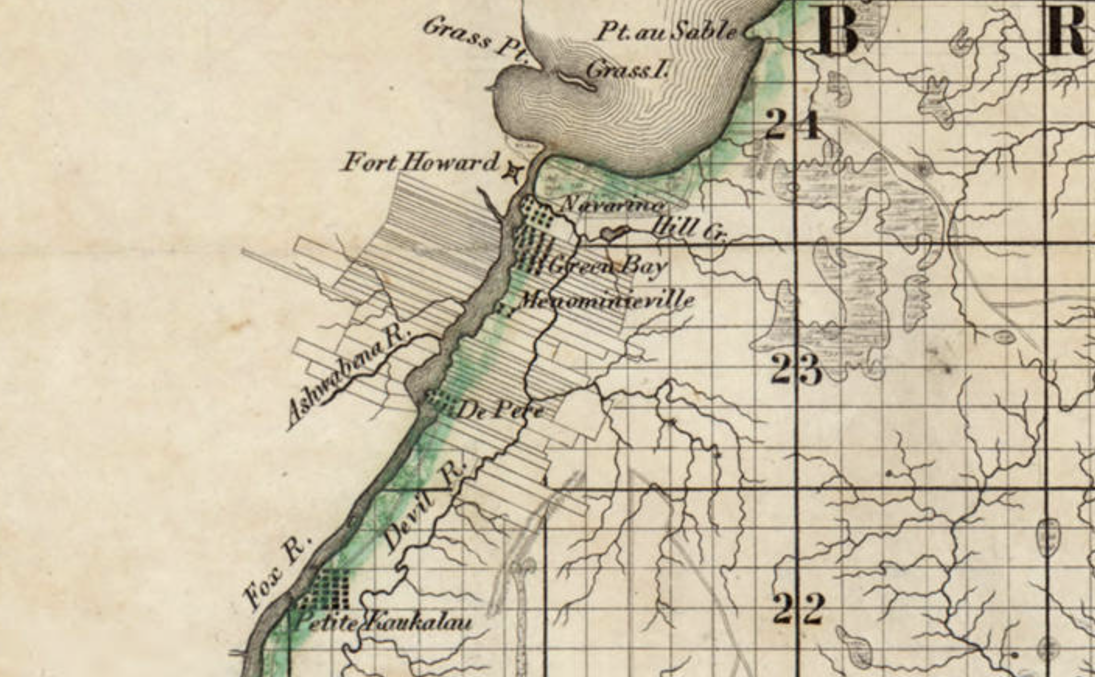
On Wednesday, as the Sun was slowly sinking to its repose in cloud of the most gorgeous and variegated colors, we arrived at the extremity of Green Bay, and about two miles up the Fox river, we landed at Navarino,2 receiving as we passed a salute from Fort Howard, on the opposite side of the river.
Detail, Topographical map of Wisconsin Territory / compiled from the Public Surveys on file in the Surveyor General’s office … by Samuel Morrison, Elisha Dwelle [and] Joshua Hathaway, 1837. American Geographical Society Library Digital Map Collection, University of Wisconsin–Milwaukee. Click the detail map to open a larger version in a new window. Click here for a link to the complete map at UW-M and its bibliographic information.
This map detail—showing Fort Howard, Navarino and, at the top, the southern end of Green Bay— is from the Topographical map of Wisconsin Territory, published in 1837 and the subject of a Monday: Map Day! post in December, 2020. As a reminder, this 1837 map shows all the lands officially surveyed by the federal government up to the time of publication. In 1837, the territory to the north and west of the Fox and Wisconsin rivers was still reserved for Wisconsin’s Native Americans, so the lands to the north and west of the Fox River are left (mostly) blank on this official map. But this land was not at all “empty.” The Indians, the forests, the wildlife, some of the old Métis and Anglo-American settlers—and the army—were all on the left bank of the Fox River in 1837, as they were in 1834, when the steamboat Michigan and its passengers arrived in Green Bay.
Our series of “How’d they get here?” posts is written to illustrate the nuts and bolts of how our early Mequon pioneers travelled from their original homes or ports of arrival in North America to the newly opened federal lands in Wisconsin Territory, circa 1830-1850. Today’s post looks at another trip to Ft. Howard on the steamboat Michigan, this time in the summer of 1834.
In Monday’s How’d they get here? – JMC to Ft.Howard, 1833, we looked at the likely probability that from October 16 – 30, 1833, Pvt. Jonathan M. Clark left the U.S. Army’s recruiting depot at Ft. Niagara, New York, and traveled the Great Lakes from Buffalo, New York, to his new post at Fort Howard, Green Bay, Michigan (later Wisconsin) Territory. To make that late-season journey the army chartered the new and lavishly appointed steamboat Michigan.
Great Lakes Tourism – Summer, 1834
Less than a year after that October, 1833, voyage the owners of the Michigan announced two special excursions to the “Far West” for the summer of 1834. The first of these was scheduled to leave Buffalo on Thursday, July 10, headed to “the Sault St. Marie (foot of Lake Superior), Michigan and Green Bay, touching at the ports on Lake Erie and at Detroit,” and would “embrace a distance of nearly 2000 miles, during which, passengers will have an opportunity of viewing the splendid scenery of Lakes Erie, St. Clair, Huron, Superior and Michigan, and the rivers, straits and bays connected with them.”
“Steamboat excursion to the Far West,” advertisement, Albany Argus, June 6, 1834, page 3, via genealogybank.com. Click to open larger image in new window.
The second trip would depart Buffalo on August 12th, and would take in all the sights of the July trip, and additional notable points along the south and east coasts of Lake Michigan, including Chicago, Michigan City, “St. Josephs,” and the mouth of Michigan’s Grand River. What could an 1834 tourist to the “Far West” expect on such an excursion? We have a first-hand report from the July trip, which includes an eventful stop at Jonathan M. Clark’s post at Ft. Howard.
Our series of “How’d they get here?” posts is written to illustrate the nuts and bolts of how our early Mequon pioneers travelled from their original homes or ports of arrival in North America to the newly opened federal lands in Wisconsin Territory, circa 1830-1850. Today’s post looks at how Jonathan M. Clark may have made the trip west to Wisconsin in October, 1833. And, in the process, we correct an important, but incorrect, date in the JMC timeline.
Jonathan M. Clark heads west…
Back in June, 2016, I outlined what we knew about Jonathan Clark’s 1833 enlistment in the army and subsequent journey to Green Bay:
After enlisting in the Army in Utica, New York, on September 19 and confirming his enlistment on September 28, 1833, Jonathan was sent to one of the Army’s “general depots.” I’ve not yet established which one he went to; the most likely places were the Jefferson Barracks in St. Louis, Missouri, or Kentucky’s Newport Barracks, on the south side of the Ohio River, across from Cincinnati. It’s possible that Jonathan may have reported to another “depot,” perhaps Ft. Niagara, New York, which was the home base of JMC’s recruiter, Capt. Clitz.
In any case, less than a month later Jonathan arrived at Fort Howard, Michigan [later Wisconsin] Territory. Fort Howard was the headquarters of the army’s Fifth Regiment, with easy water access via Lake Michigan to Ft. Dearborn, Chicago and, via the Fox and Wisconsin rivers, to Forts Winnebago and Crawford.
Now that we know more about early transportation routes from New York to Wisconsin it seems unlikely that JMC reported to either the Jefferson Barracks or the Newport Barracks before arriving at Fort Howard. Yes, it would have been relatively easy to travel from Utica, New York, to either the Jefferson or Newport barracks via the Erie Canal to Lake Erie, and then the Ohio canals and Ohio river. But Fort Howard was one of the army’s northernmost posts. If JMC had been shipped to one of the main personnel depots in Kentucky or Missouri, the northward trip from either place to Green Bay and Ft. Howard would have been needlessly long and difficult.
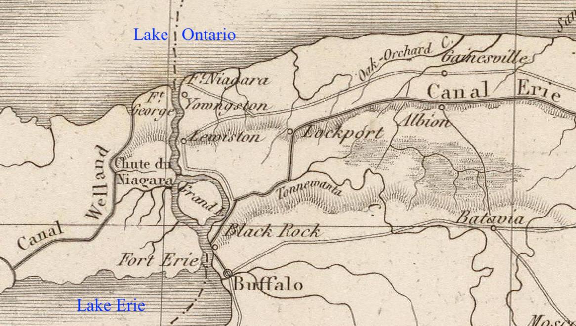
Fort Niagara
I now suspect that Jonathan Clark mustered in to service at Fort Niagara, New York.2
Map detail, showing western New York state, including Ft. Niagara, the Erie Canal, and Buffalo, from Poussin, Guillaume-Tell, Travaux d’ameliorations interieures projetes ou executes par le Gouvernement General des Etats-Unis d’Amerique, de 1824 a 1831 … Atlas. Paris, Anselin, Libraire, pour l’art militaire, les sciences et les arts, […],1834. Imprimerie de Lachevardiere, rue du Colombier, No. 30. Credit, David Rumsey Map Collection, David Rumsey Map Center, Stanford Libraries, non-commercial use permitted under Creative Commons license. Click image to open larger image in new window.1
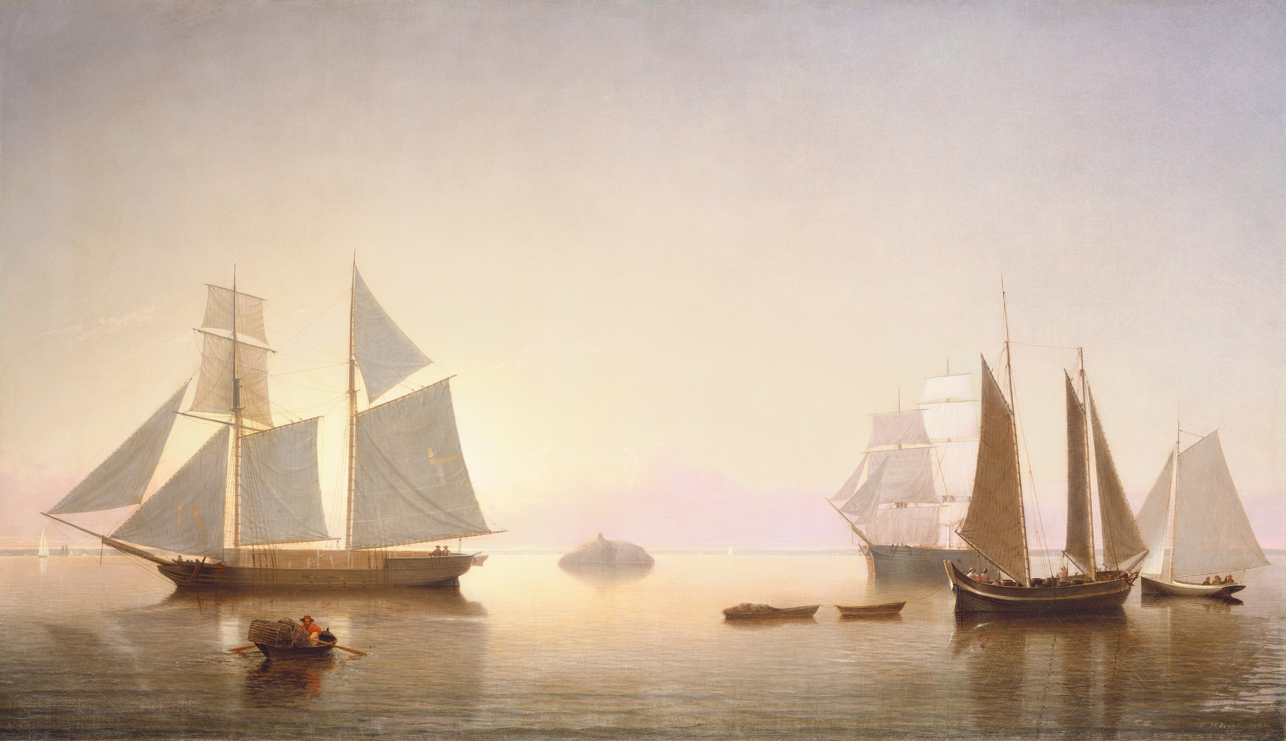
Fitz Henry Lane, painter (American, 1804-1865), Becalmed off Halfway Rock, 1860, oil on canvas, National Gallery of Art, Collection of Mr. and Mrs. Paul Mellon, in Honor of the 50th Anniversary of the National Gallery of Art. Public Domain. Click to open larger image in new window.
Previously, we turned our thoughts to the historic city of New Orleans, and the disastrous impact of then-ongoing Hurricane Ida. Once again the Crescent City was hit by a major hurricane. Ida has since moved on and lessened in intensity, but leaves in its wake significant wind and water damage; over one million Louisiana residents are currently without electricity, gasoline, and fresh water, and it looks like it will take weeks to restore services. We wish a speedy recovery for all those in the affected areas.
I have a more-than-passing interest in New Orleans because our Clark House family has ties to the city; Mary (Turck) Clark’s brother, Joseph Robert Turck (1823-1902), spent most of his adult life there.
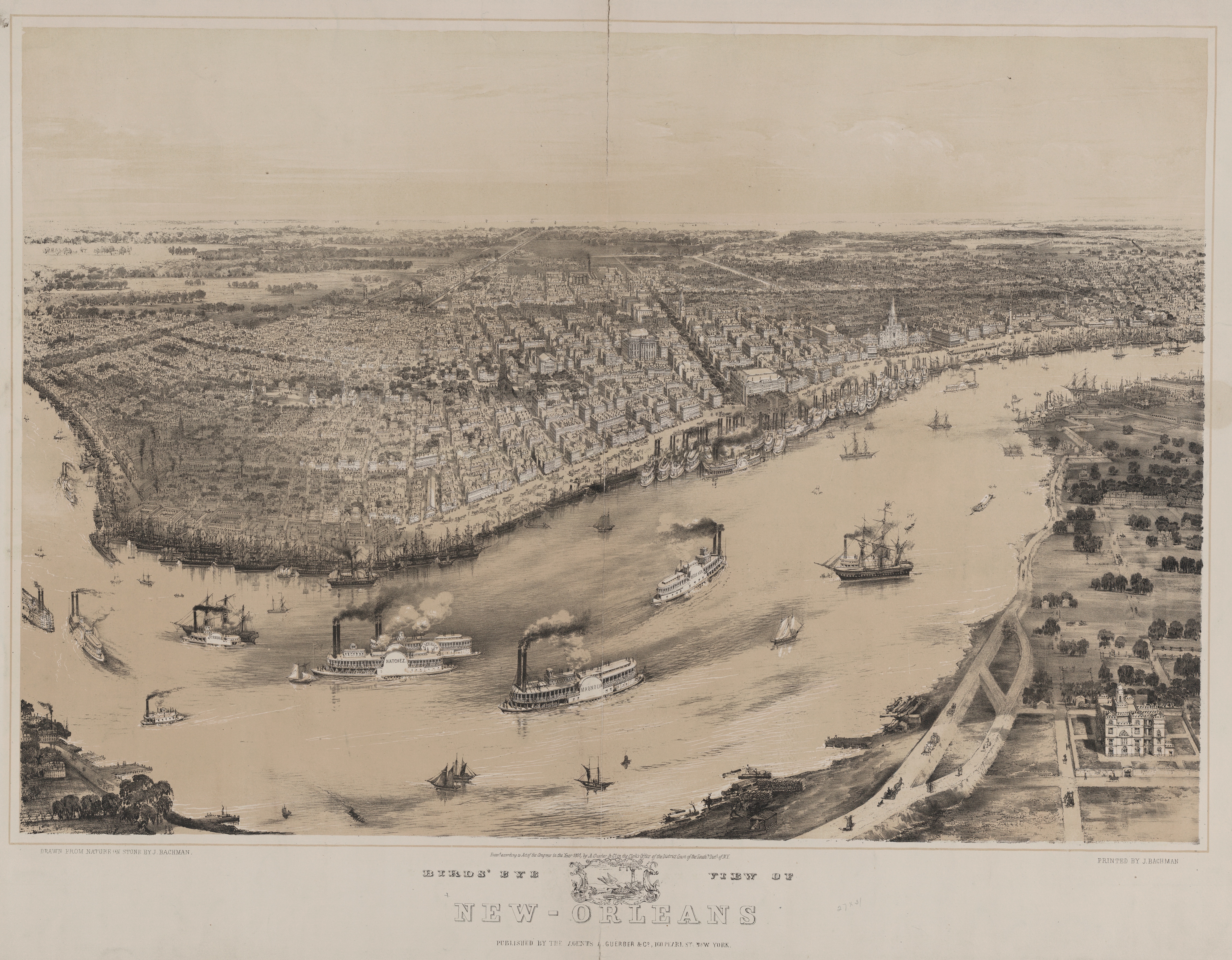
New Orleans, Louisiana Sugar and Rice Exchange, c. 1891. Source and credits, below (note 1). Click to open larger image in new window.
Joseph R. Turck
Like his big sister Mary, Joseph R. Turck was born in Athens, Greene county, New York. He was about five years old when the family moved to Wayne county, New York, and about fourteen years old when the family migrated west to Mequon in 1837.
In February, 1845, Joseph purchased 40 acres of his father Peter Turck’s Mequon land.2 Joseph did not keep it long; he sold it back to his father in September of the same year. What happened next? We’re not sure. But by 1848 Joseph had left Wisconsin and relocated to New Orleans.
Once again, several states along and north of the Gulf of Mexico face the force of a major hurricane. As I type this, New Orleans, one of the most historic cities in the United States, is without power, and hundreds of thousands of citizens—and large parts of the the area’s industries and environment—remain threatened as Hurricane Ida makes its way inland. I’ll let other, more knowledgable sources report the news. For now, I encourage you to remember and support our compatriots as they endure and recover from this major natural disaster.
Bachmann, John, Birds’ eye view of New-Orleans / drawn from nature on stone by J. Bachman, [i.e., Bachmann], ca. 1851. New York: Published by the agents A. Guerber & Co., Printed by J. Bachman. Library of Congress. Click to open larger image in new window.
Our series of “How’d they get here?” posts is written to illustrate the nuts and bolts of how our early Mequon pioneers travelled from their original homes or ports of arrival in North America to the newly opened federal lands in Wisconsin Territory, circa 1830-1850. Today’s post continues our westward journey from Buffalo; see Note 1 (below) for links to earlier posts in the series.
The ships at Detroit, 1837
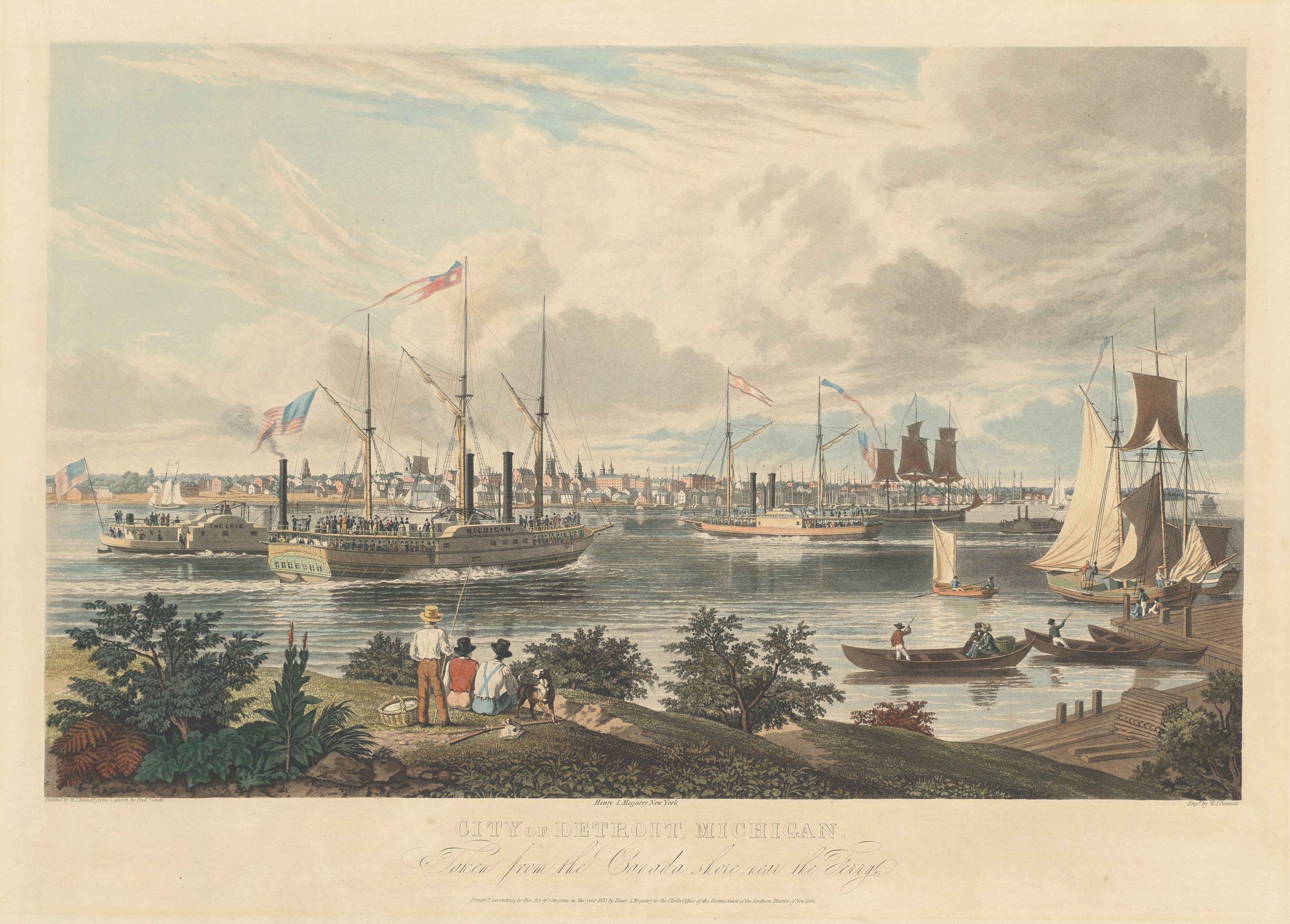
We closed our previous post with a brief look at a colorful aquatint of the ships and small craft on the Detroit River, a major port on the Great Lakes route between Buffalo and Chicago in the 1830s and ’40s. The print was published in 1837, and is an excellent illustration of almost all of the important types of ships in use during the years of Wisconsin Territory settlement:
Bennett, William J., after a sketch by Frederick K. Grain, City of Detroit, Michigan. Taken from the Canada shore near the Ferry., hand-colored aquatint on engraving, ca. 1837. National Gallery of Art, Collection of Mr. and Mrs. Paul Mellon. Public Domain. Click to open larger image in new window.
If you’re not clear on your Michigan and Upper Canada (now Ontario) geography, the artist was standing on the Canadian shore, looking west across the river to the city of Detroit. The two steamboats at the left center of the picture are headed north, upstream on the Detroit River that connects Lake Erie to Lake St. Clair and, via the St. Clair River, to Lakes Huron, Michigan and Superior.
Given that the picture shows leafy green foliage and men in shirt-sleeves, it was probably drawn in the spring or summer of 1837 (or a perhaps a year or two earlier?). In August, 1837, the Peter Turck family—including eldest daughter Mary Turck—migrated from Wayne county, New York, to Milwaukee via this exact route and, perhaps, on one of the ships shown in this picture. Other Mequon immigrants, including the Bigelow, Bonniwell, Loomer, Strickland and Woodworth families (and many others), would have seen similar views as they travelled from the eastern seaboard to Wisconsin Territory in the ’30s and ’40s.
There is a lot to see here. Let’s take a closer look…