The Clark Family in 1860

UPDATED, December 27, 2020, to correct a typo in the list of family ages. Mary Clark was enumerated as age 39 (not 44 as previously mis-typed). —R.P.

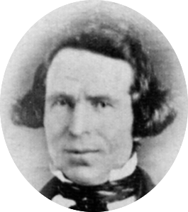
The death of Jonathan M. Clark in September, 1857, must have been a tremendous blow to his family. Suddenly, Mary Turck Clark was a 37-year-old widow, with a nursing infant and seven other children, all under the age of 17. She had a family to raise, a 160-acre farm to manage, and important decisions to make.

What to do? Remarry for economic security? Sell the farm and move to Milwaukee for a better education for the children? Her father, Peter Turck, was already living in the city with his second wife, Christina, and their 8 year old daughter; could she and the children move in with them? Or would Mary find a new home of her own in the city?

Still here

Mary decided to stay, and make a go of it on her own. When the federal decennial census was enumerated in the summer of 1860, Mary and the children were still on the farm in Mequon:

Continue reading

Monday: Map Day! – Another look at Ouisconsin Territory, 1836

UPDATED, February 11, 2024, to include a revised annotated map. But for the full update—with additional notes and corrections—please see the most recent version of this, posted on February 12, 2024.

As a kind of postscript to our look at the early Wisconsin territorial, state and federal censuses, today’s Monday: Map Day! revisits an interesting map that we first discussed on October 29, 2017. Today’s post includes a few updates and corrections based on new information. 

It’s 1836. Where’s…Wisconsin?

In September, 1836, Sgt. Jonathan M. Clark was discharged from the U.S. Army at “Camp Hamilton,” Wisconsin Territory. after serving his three-year term of service with Co. K, Fifth Regiment of Infantry.1  One year later, in the autumn of 1837, Jonathan’s future wife Mary Turck would make the long trip from Palmyra, New York, to Milwaukee and finally Mequon, Washington County, Wisconsin, with her parents Peter and Rachael Turck and six younger siblings. By the end of 1840 Jonathan and Mary would be married and starting their family in Mequon.

That seems simple enough, until you take a moment to wonder how much Jonathan—or especially Mary and her family—knew about this new Wisconsin Territory.  Jonathan had been in the territory since October, 1833, mostly on post at Ft. Howard. In the last year or so of his service he was busy cutting trees and building bridges for the military road along the Fox River waterway from Ft. Howard (Green Bay) towards Ft. Winnebago (near modern Portage). As a road-building soldier, Jonathan might have done some surveying and seen—or helped draw—a variety of maps of the military road and its vicinity. But for a better overview of this new territory, Jonathan or Mary might have sought out a map such as this2:

Continue reading

1857: Disaster

As the year 1857 began, things seemed to be going well for the Clark family. Jonathan M. and Mary Turck Clark had been married for seventeen years. On May 25, 1857, they welcomed the birth of their eighth child, daughter Jennie Marietta Clark. She joined six older sisters—Caroline, Elizabeth, Persie, Theresa, Laura and Josie—and one brother, Henry.

The family had been living in their handsome, two-story home of stone and wood—now the Jonathan Clark House Museum—for nine years. They owned 160 acres of fine farmland, and appeared to be one of the more successful and comfortable farm families in the area.

But not all was well in the neighborhood. In November, 1856, typhus struck Rev. James W. Woodworth’s father, Peter. By late December, Rev. Woodworth’s daughters Rosetta and Julietta were both ill with the disease. In early February, Rev. Woodworth’s wife, Cerena Loomer Woodworth was taken ill with typhus, followed by daughter Sophia a few days later.

Continue reading

Summer in the Kitchen

I’m working on a number of longer posts, none of which are ready yet. So how about a Jonathan Clark House Museum photo instead?

Part of the kitchen at the Jonathan Clark House museum, Mequon, Wisconsin, July, 2016. Photo by Anna Perkins, used by permission. Click to open larger image in new window.

Mary Turck Clark—and the Clark children—probably spent part of each spring, summer and early fall day tending a sizable herb and vegetable garden. Herbs added flavor to food and were also valued for their medicinal properties. But herbs often grow faster than you can use them. What to do? Hang them up to dry, and enjoy their scents, flavors and healing qualities throughout the coming year.

In early July, if the weather had been good—lots of sun and perhaps an inch or two of rain each week—the Clark family might have enjoyed the first fresh green beans of the summer. That would have been a real treat after months and months of dried produce and the last, tired, potatoes, turnips, onions, carrots and such from the root-cellar1.

By the time autumn arrived, the last beans on the bush would have been big and kind of stringy. Not as tasty as the mid-summer beans, they would be hung up to dry so that the beans could be saved, ready for planting the next spring.

Continue reading

Monday Miscellany!

Clark House News and an Update

I hope you enjoyed your Independence Day weekend. Our “Monday: Map Day!” feature is taking the week off. In its place, here is a round-up of some recent Jonathan Clark House news and a blog update/correction or two.

Three Cheers for Liz!

I was glad to assist Clark House museum director Nina Look in putting together this “tip of the hat” to Clark family descendant and stalwart Jonathan Clark House Museum friend and supporter Liz Hickman. This went out to Clark House board members and volunteers in mid-June, and I’m happy to share it with you here:

Continue reading

July 4, 2020

Pulling down the statue of George III by the “Sons of Freedom,” at the Bowling Green, City of New York, July 1776, painted by Johannes A. Oertel, engraved by John C. McRae, New York : Published by Joseph Laing, [ca. 1875]. Library of Congress http://loc.gov/pictures/resource/pga.02158/. Click to open larger image in new window.

After a public reading of the Declaration of Independence at Bowling Green, on July 9, 1776, New Yorkers pulled down the statue of King George III. Parts of the statue were reportedly melted down and used for bullets. (Source, Source)

For much of my lifetime, people—including many that should know better—have discoursed at length on whether history is “relevant” in our modern era. I wonder if that is because too many Americans simply don’t know much of their own history. For example, how many Americans today support these political sentiments?:

In Congress, July 4, 1776.

The unanimous Declaration of the thirteen united States of America, When in the Course of human events, it becomes necessary for one people to dissolve the political bands which have connected them with another, and to assume among the powers of the earth, the separate and equal station to which the Laws of Nature and of Nature’s God entitle them, a decent respect to the opinions of mankind requires that they should declare the causes which impel them to the separation.

We hold these truths to be self-evident, that all men are created equal, that they are endowed by their Creator with certain unalienable Rights, that among these are Life, Liberty and the pursuit of Happiness.–That to secure these rights, Governments are instituted among Men, deriving their just powers from the consent of the governed, –That whenever any Form of Government becomes destructive of these ends, it is the Right of the People to alter or to abolish it, and to institute new Government, laying its foundation on such principles and organizing its powers in such form, as to them shall seem most likely to effect their Safety and Happiness.

Continue reading

Census Records for the In-Between Years: 1838

UPDATED, July 24, 2021 with another spelling and additional info on early settler S. McEvony-McEvery-McEvany.

The Second Wisconsin Territorial Census

The second Wisconsin territorial census, taken in 1838, is the only Wisconsin territorial census we have not yet discussed here at Clark House Historian. If you need to catch up, at the end of this post is a list of our previous discussions of Jonathan Clark, Mary Turck, and their family on the federal, territorial and state censuses enumerated between 1836 to 1855.

By early 1838, several new counties—Dodge, Jefferson and Washington—had been created from the original, larger, Milwaukee and Brown counties, although the new counties were still “attached” to Milwaukee county for judicial purposes.1 This means that the 1838 territorial census of the newly-created Jefferson, Dodge and Washington counties was the responsibility of the Milwaukee county enumerator, Sheriff Own (sic) Aldrich.

The filmed images for the second Wisconsin territorial census, enumerated in 1838, are available online as FHL film no.1,293,919 , aka DGS film 7,897,817 (Item 2, following the 1836 census. The 1838 census begins at image 118 of 532). Here’s the first page of the Milwaukee county census (including the attached counties of Jefferson, Dodge and Washington):

Continue reading

Census Records for the In-Between Years: 1836

Where’s Jonathan Clark?

Wisconsin’s first territorial census was enumerated in the summer of 1836. Our previous Monday: Map Day! post discussed the extent of the Wisconsin Territory in 1836, and outlined the few—very large and lightly populated—counties that were enumerated on that first census. If you missed it, you might want to read that post first.

Today’s post was originally planned to be a quick few paragraphs outlining the 1836 territorial census procedures and explaining how Jonathan M. Clark was, alas, probably not enumerated on this census; and if he had been, then we’d never find him; why that might have been; how this was not unusual for its era; and so forth. But! It turns out that we can find the “family” that Jonathan was enumerated with, though it’s kind of complicated, so bear with me.

The Wisconsin Territorial Census of 1836

The 1836 Wisconsin territorial census was typical for its time and purpose. The sheriff of each county was charged with enumerating four categories of white persons in his area:

  • Number of males under 21 years
  • Number of females under 21 years
  • Number of males over 21 years
  • Number of females over 21 years

There were no pre-printed forms; each sheriff used blank paper, a pen and a ruler to record the data. If you look at the actual returns (available online as FHL film no.1,293,919 , aka DGS film 7,897,817), you’ll find that the enumerators often recorded additional information not required by the authorizing legislation. (The Crawford county sheriff was particularly enthusiastic, subdividing his information into 13 age-groups for white males, 13 age-groups for white females, 6 age-groups for enslaved males and 4 age-groups for enslaved females.) The Brown county sheriff, as you can see (below), remained closer to his legislated mandate, and chose to enumerate five categories of white settlers:

Continue reading

Monday: Map Day! – Wisconsin Territory, ready for its 1st census, 1836

.

The vast Wisconsin Territory originally included all the current states of Wisconsin, Minnesota and Iowa, and that part of the Dakotas east of the Missouri River. The Wisconsin Territory officially existed from July 3, 1836 until the current—and smaller—State of Wisconsin was established on May 29, 1848. The history of the territory prior to statehood, and especially before mid-1836, is complicated. For more information you might begin with this overview. Here’s an outline map of the territory:

[Map of Wisconsin Territory, April 20, 1836] original from Wisconsin Historical Society, Wisconsin Historical Collections, 11, this image from Wisconsin Historical Collections, 13:248.

Section 4 of the April 20, 1836 act of Congress that created the Wisconsin Territory, required that

Previously to the first election, the governor of the Territory shall cause the census or enumeration of the inhabitants of the several counties in the territory to be taken or made by the sheriffs of said counties, respectively, and returns thereof made by the said sheriffs, to the governor.

Act of Congress, April 20, 1836, quoted in Wisconsin Historical Collections, 13:247.

With such a large expanse of land, and relatively small number of white inhabitants, the Wisconsin Territory of 1836 was divided into only a few counties. Two of these, Dubuque and Des Moines counties, lay to the west of the Mississippi river and comprised the Iowa District of the Wisconsin Territory. (Both were enumerated in the 1836 territorial census, but I’ll let Iowa history fans follow up on those counties.) Here a map of the 1836 Wisconsin Territory counties lying east of the Mississippi River:

Continue reading

Census Records for the In-Between Years: 1855 — Part 2

Who’s On That 1855 Census Page?

This is a follow-up to our previous post about the Jonathan M. Clark family and the 1855 Wisconsin state census. You might want to read that post first, and also take a look at our recent discussion of English/Latin and German Kurrent hand writing styles as used in places like Wisconsin in the 1800s.

In the comments to that 1855 state census post, blog reader and Clark House friend Liz Hickman asked:

Am curious about the others listed on the page; starts with James Woodworth [Rev.?]. Do you see any other names of interest? Can you figure out the name below Jonathan’s?

Liz Hickman, reply to Census Records for the In-Between Years: 1855

Thanks again, Liz, let me see if I can help. First of all, let’s take a look at that first page of the Mequon return for the 1855 state census:

Continue reading