I’m chipping away at my sources, trying to carve out a coherent post or two.

Revised May 13, 2022 to correct spelling of Nathaniel Currier’s name.
It’s mid-May in southeastern Wisconsin, and with luck the last frost is behind us. For the past weeks and months farmers and gardeners have been tending to the soil and preparing for planting. At this time of year in the 1840s and ’50s, Jonathan M. Clark would have done much the same, hitching up his team of oxen to a steel-bladed plow to cut and turn over the tough prairie grasses and break up the soil of his newly-cleared lands.

Infrastructure Week Fortnight Month continues…
It’s been a busy few weeks here at the Historian’s (actual) house, and I’m (very) slowly transcribing handwritten documents and making maps to illustrate the work of Jonathan M. Clark and his fellow road supervisors as they mapped and built old Washington County’s first roads in early 1841. While you’re waiting for those posts, check out our previous installments in this series — County Government – Early Records and Monday: Map Day! — for some interesting background, maps, and first-hand records.
Jonathan Clark – surveyor?
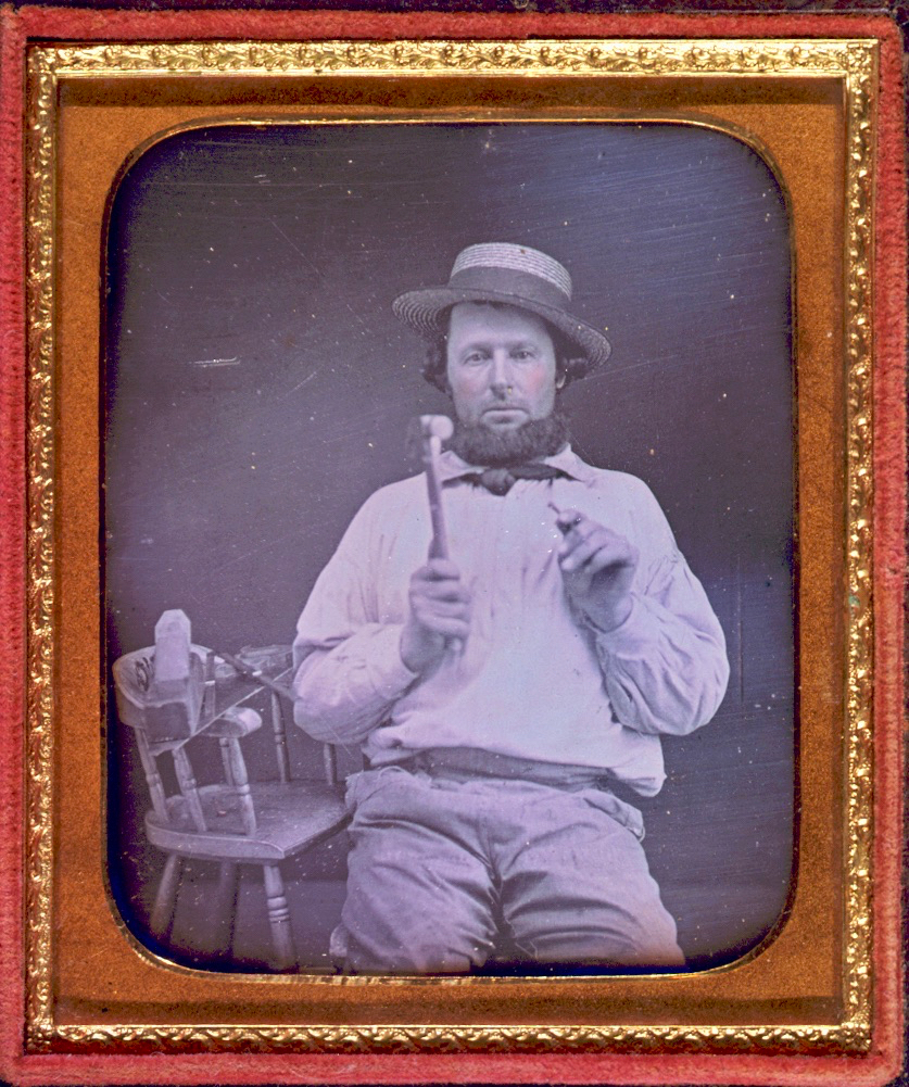
What did Jonathan Clark know about surveying and road building? Probably quite a bit. Like most farmers—then and now—Jonathan would not have been successful without a good understanding of maps, distances, land boundaries and how to best use and navigate the fields, forests and wetlands of his property.
If you recall our earlier posts detailing JMC’s military service (starting with Fort Howard, October 1833 (part 1) and including Ouisconsin Territory, 1836), you’ll remember that his unit, the U.S. Army’s 5th infantry regiment, was responsible for laying out and cutting the new military road that would ultimately connect Ft. Howard in Green Bay, Ft. Winnebago near Portage, and Ft. Crawford at Prairie du Chien. Jonathan’s Co. K was involved in this work for the better part of his final two years of service (1835-1836). This assignment would give him hands-on experience in surveying, map-making, grubbing out roads and building serviceable bridges with the materials at hand. By the time he arrived in Mequon, in late 1839, it’s possible that Jonathan Clark was the most experienced road builder (and one of the better surveyors) in early Washington/Ozaukee county.
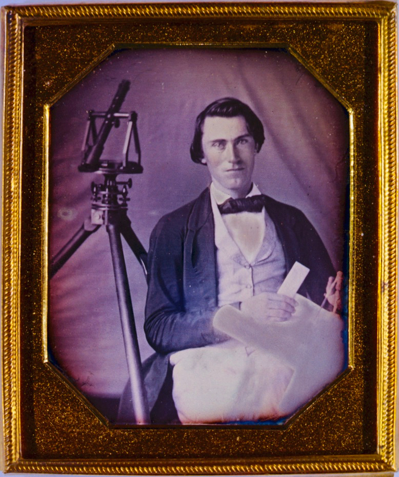
A surveyor and his tools…
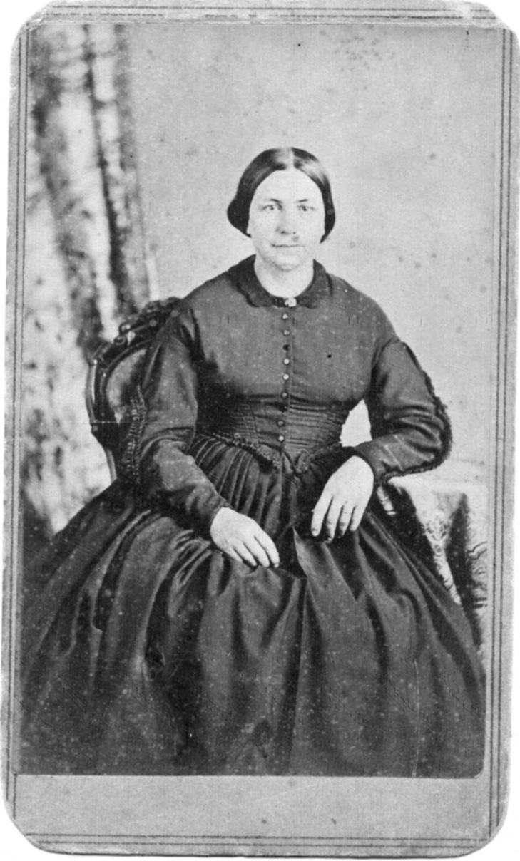
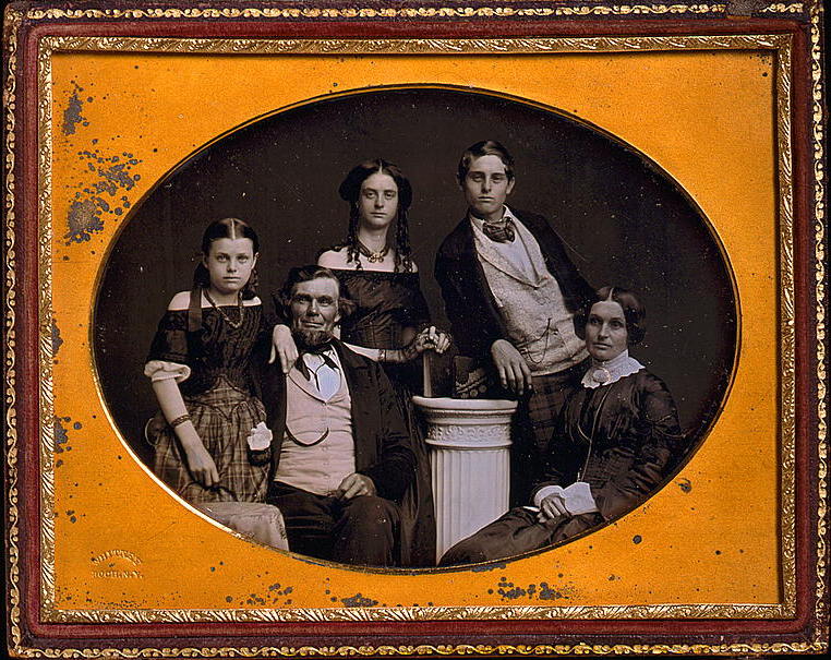
Today, May 3, 2021, marks the 200th birthday anniversary of Mary Turck, the eldest child of Peter Turck and Rachael (Gay) Turck, and future spouse of Jonathan M. Clark. Mary and Jonathan were married in old Washington county on March 15, 1840, and began to farm their Mequon land the same year. They went on to build their handsome stone house—now the Jonathan Clark House Museum—in 1848.
I’ve recently returned to my job behind the counter at the local mercantile. This is good—for all sorts of practical reasons—but requires an adjustment to my research and writing schedule that I’ve not quite figured out. Yet.

Main counter and clerk, 1880s General Store at Old World Wisconsin, July, 2016. Photo by Reed Perkins. Click to open larger image in new window.
I should be back with the conclusion of Infrastructure Week! next week. Meanwhile, here are a few more photos of the General Store at Old World Wisconsin — “big box” retail at its finest, circa 1880.
Continue readingInfrastructure Week! — part 1
Last week’s Monday: Map Day! discussed the Milwaukee and Superior railroad, and the right-of-way through the middle of the Clark farm property that it purchased from Jonathan and Mary Clark in 1857. Even if you already read it, take another look. I’ve recently updated that post to include corrections and new information from reader Sam Cutler (thanks, Sam!).
Today’s post begins Infrastructure Week! a short series focused on the first infrastructure projects in old Washington/Ozaukee county, beginning with the 1841 appointment of the first county road supervisors and their districts.
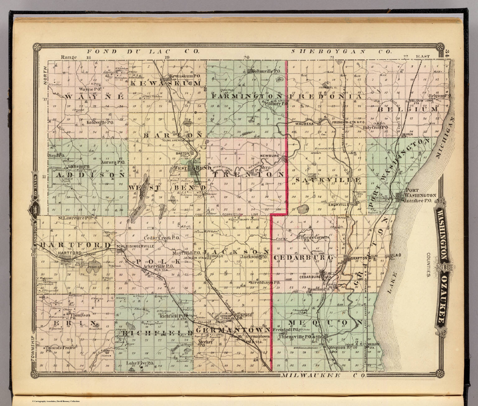
Old Washington/Ozaukee County, 1837
In order to proceed with county business, the original county commissioners must have had an authoritative map that showed the official county and township boundaries. I would not be surprised if they owned a copy of the 1837 Topographical map of Wisconsin Territory, showing the lands that had been surveyed by, and were available for purchase from, the federal government. As we discussed earlier, this was the first large-scale map of the Wisconsin Territory based on actual surveys. Here’s a detail from that map, showing old Washington county as the 1841 county commissioners would have understood it:

No posts this past Wednesday or Friday. I’ve been enjoying some fun time with my family.
UPDATED, April 26, 2021, to incorporate some interesting observations and corrections from reader Sam Cutler. (See the comments, below.)
I’ve had a busy weekend, and not much time to write. But I found an interesting, Clark- and Mequon-related map you may not have seen before.

The Jonathan M. Clark House is located in Mequon, Ozaukee (formerly Washington) County, Wisconsin. In our previous post, Mequon – What’s in a name?, we looked into how Mequon became a political entity and how its goverment evolved from the county system to the town system.
From…which archives?
Where do you look when you’d like to read (and download) the handwritten minutes of the meetings of old Washington county’s commissioners, circa 1841-1846? How about…the Washington Co. Highway Department!
This actually makes more sense than you might think, since many of the county’s earliest decisions and expenditures involved proposing, surveying and cutting roads to connect new settlements to each other, to the rest of Wisconsin Territory, and beyond. So—in a fine example of professional organization and public service—the Washington county highway department has gathered together and put online many of their oldest records.
The County Highway Register was an attempt to search out, correlate, and record all known information concerning the laying out of all roads in the county. Some of these books have not been updated since the mid to late 1950’s. Read the forward in the index to understand how these books were created.
If you follow the link, you’ll find an long list of pdfs, organized by Washington County towns, that contain the collected official highway records and some of the earliest records of county government.
But…Washington County?