I’m still working on several larger Clark House Historian projects, but I still have time to share a few Random Bits O’ History with you…
More Fun with Fraktur
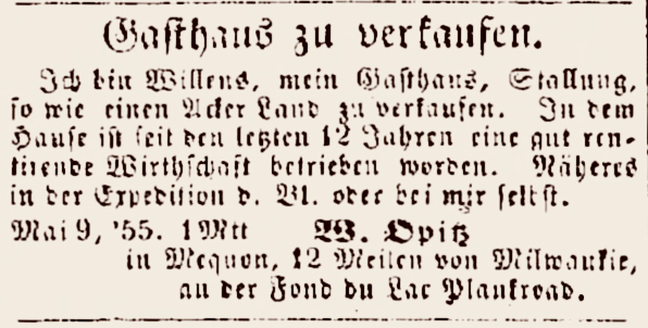
You may remember our recent post, William Opitz – real estate agent (1855), in which we noted the start of a new business venture—a “Land Agency”—by one of Mequon’s earliest and most influential German settlers, Wilhelm Ferdinand “William F.” Opitz (1813 or 1816 – 1882). Well, I found a companion advertisement from W. F. Opitz, published on page 2 of the Milwaukee Banner und Volksfreund on May 18, 1855:
In an earlier post, “Intensely Cold Weather,” we examined the negative effects of several episodes of bitterly cold winter weather during the Clark family’s era and shortly afterwards. Today we look at some of the positive aspects of frigid winters in our part of the Old Northwest.
It’s no secret. Wisconsinites like to do stuff outdoors in the winter cold. Ice fishing. Skating. Cheering for the Packers.
But the Green Bay Packers professional football team wasn’t organized until 1919, a full eighty years after Jonathan M. Clark bought his first parcel of Mequon land in 1839. So what did our intrepid Wisconsin pioneers do back in the mid-1800s when those deep snows fell and cold north winds began to blow? Well, if you believe the newspapers of the era, there was no finer way to occupy a clear, frosty day—or moonlit evening—than to bundle up, go outside, and enjoy a…
As I write this, southeastern Wisconsin is in the midst of our first substantial snowfall of Winter, 2025-2026. In Jonathan and Mary Clark’s lifetime, the day after a storm like this meant it was time to hitch up the sleigh and have some fun “dashing through the snow.” Here’s a lightly-revised and expanded repeat of a post that celebrates Clark-era “sleighing time” and “jingle bells.” (And be sure to click the highlighted links for more vintage wintertime images and info.)
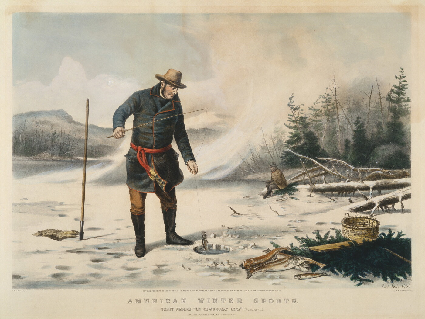
Kimmel and Forster, publishers, “Winter Pleasure in the Country,” circa 1865. National Museum of American History, Peters Prints Collection, Smithsonian Institution.1 Note the modest straps of jingle bells on the one-horse sleigh and the much more ostentatious—and louder—straps of bells on the two-horse sleigh.
Last winter, our earlier CHH posts Snow!, Shoveling out -and other winter chores and Stuff Happens – on a sleigh ride, got me wondering again about winter travel in old Washington/Ozaukee county during the Clarks’ era of the mid-1830s through the 1860s or so. Assuming most of the more successful farmers—such as the Clarks, Bonniwells and Turcks—owned a one- or two-horse sleigh, how easy was it to navigate that sleigh on the early county roads? Could you sleigh ride all the way to Milwaukee? And if you could, how long might that take?
Kimmel and Forster, publishers, “Winter Pleasure in the Country,” circa 1865. National Museum of American History, Peters Prints Collection, Smithsonian Institution.1
Talk of sleighs and sleighing in our recent CHH posts on Snow! and Shoveling out -and other winter chores, plus our January, 2022, essay on Stuff Happens – on a sleigh ride, got me wondering again about winter travel in old Washington/Ozaukee county during the Clarks’ era. Assuming most of the more successful farmers—such as the Clarks, Bonniwells and Turcks—owned a one- or two-horse sleigh, how easy was it to navigate that sleigh on the early county roads? Could you ride all the way to Milwaukee? And if you could, how long might that take?
We’ve had some snow in my corner of southeastern Wisconsin, several modest snowfalls over the past few days. I’ve had to shovel the walks and driveway at our house a few times this week, and there’s more snow—and shoveling—in the forecast. With that in mind, I thought you might enjoy the snow-related images and stories from a revised edition of this post, which originally appeared here in February, 2023.
Homer, Winslow, A Winter-Morning,—Shovelling Out, 1871. Wood engraving. Brooklyn Museum, Gift of Harvey Isbitts.
Winter chores
I empathize with the lads in this 1871 engraving by Winslow Homer. Unlike these fellows, with their (homemade?) wooden shovels, I have a lightweight, sturdy, ergonomic, plastic and metal snow shovel to work with. And although we do get snow in 21st-century Wisconsin, I haven’t had to deal with shoulder-high accumulations like the ones in Homer’s picture since I lived in western Massachusetts in the early 2010s. It looks like our 1871 snow shovelers are dealing with the kind of snowfall that Clark family neighbor Rev. James W. Woodworth described in these January, 1871, diary entries:
Hey there! We finally got some snow in southeastern Wisconsin, which prompts me to republish this essay, which originally appeared in early 2021, and has been updated and re-posted several times since. Have fun outside—or enjoy a warm beverage inside—and admire the snowy winter landscape while you can. Cheers!
Snow, and often lots of it, was a feature of Jonathan and Mary Clark’s life in Wisconsin. And if you wanted to go to town or church or visit your neighbors during the snowy Wisconsin winter—or just enjoy a pleasant winter ride in the country—you’d need a sleigh.
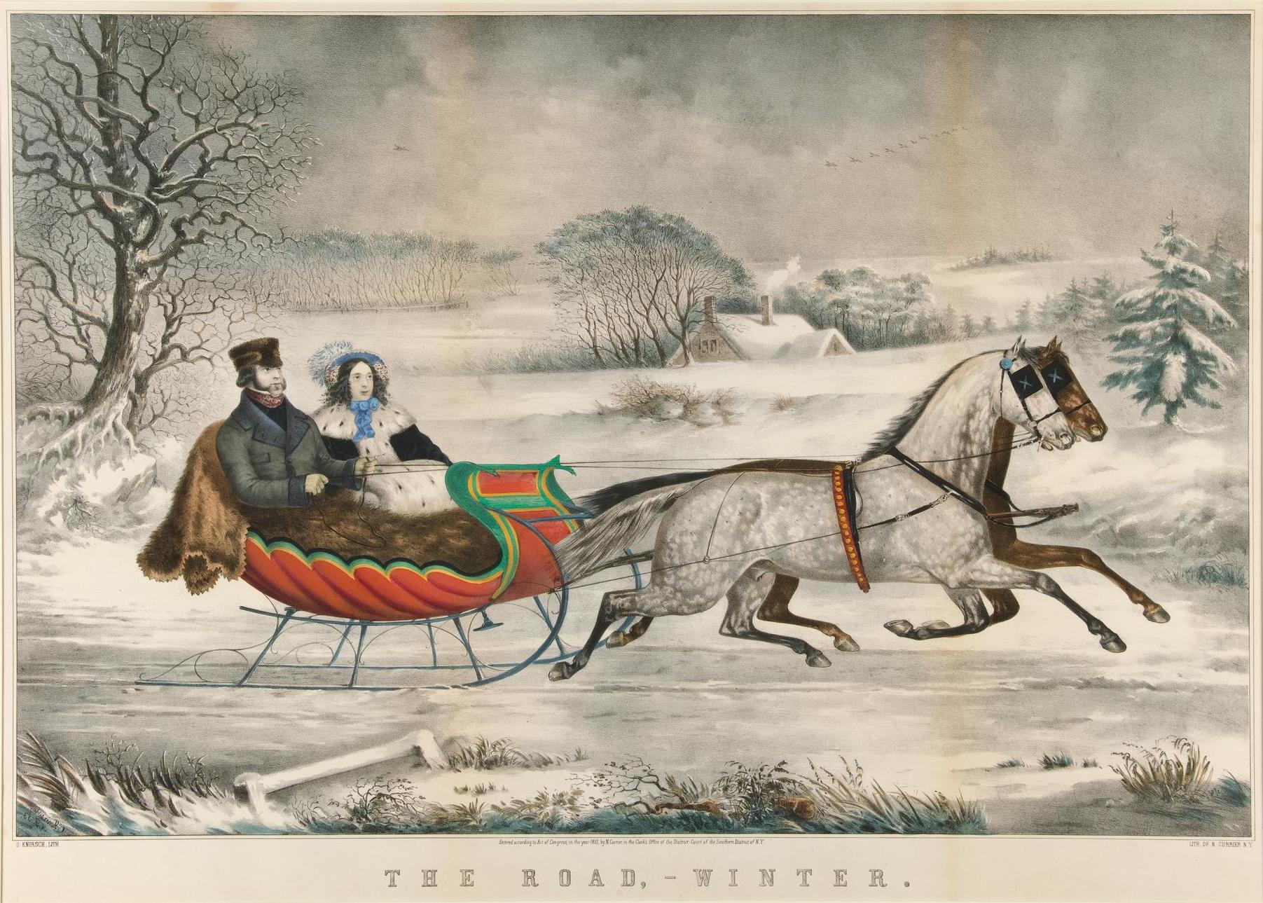
Currier, Nathaniel (1813-1888), The road, winter / O. Knirsch, lith., 1853. New York: Published by Currier & Ives. Yale University Art Museum, Whitney Collections of Sporting Art, given in memory of Harry Payne Whitney (B.A. 1894) and Payne Whitney (B.A. 1898) by Francis P. Garvan (B.A. 1897) June 2, 1932. Public domain. Click to open larger image in new window.1
We don’t know if the Clarks owned a sleigh while they lived in Mequon. I suspect they did, though their sleigh—and their clothing—may not have been quite as posh as those in this Currier & Ives lithograph from 1853.
UPDATED October 5, 2024, at 9;30 pm to correct a number of typos and other infelicities.
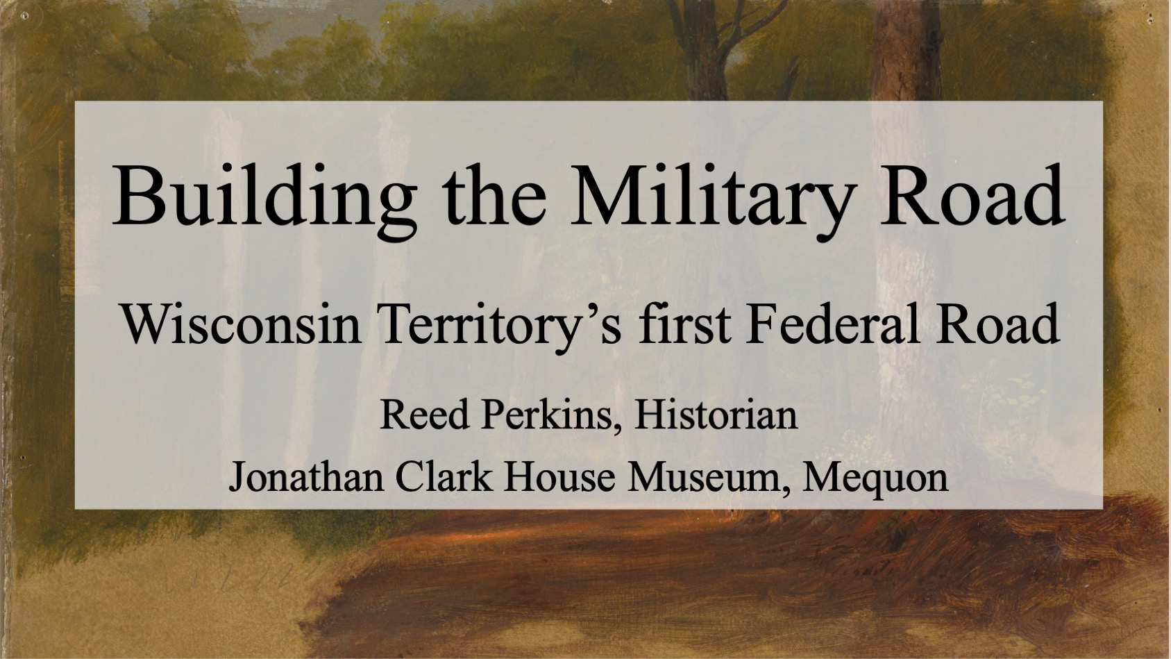
Phew! What a busy September! I got to talk about some very interesting topics last month, to some very enthusiastic and attentive audiences. Lots of work, but very enjoyable. The first of these events was my September 13, 2024, after-dinner presentation at the Fall Workshop of the Wisconsin Society, Daughters of the American Revolution (WSDAR). My topic was “Building the Military Road, Wisconsin Territory’s First Federal Road.”
Photo credit: Laura Rexroth
I incorporated into the talk some important parts of the 1830s and ’40s army and road-building information that I’ve blogged about here at CHH, as well as new primary source materials and a whole bunch of relevant photographs and illustrations.
The WSDAR and the Military Road
An important, ongoing part of the WSDAR’s mission over the decades is historic preservation and education. The Wisconsin Society DAR’s main historic preservation effort involves the care and presentation of the last bit of Fort Winnebago still standing, the historic Fort Winnebago Surgeon’s Quarters.
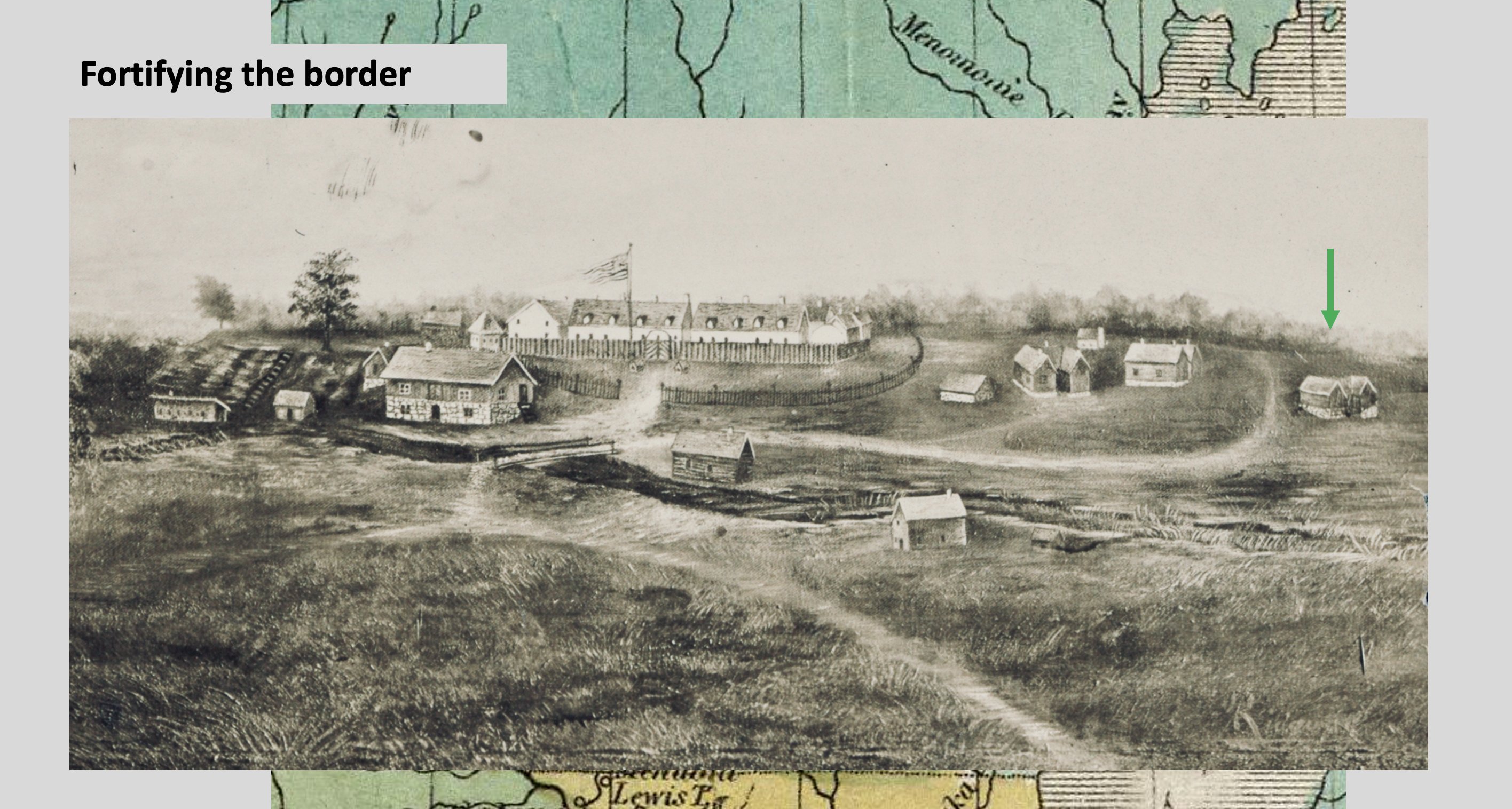
“Fortifying the Border,” slide from my “Old Military Road” presentation.
This image of Fort Winnebago, at the Portage between the Fox and Wisconsin Rivers, was created in the mid-nineteenth century and reproduced on a 1909 postcard. In the detail shown here, the building that is now the WSDAR’s historic Fort Winnebago Surgeon’s Quarters museum is indicated by green arrow. The uncropped full image—including a view of the Historic Indian Agency House—is available from the Library of Congress.
The WSDAR also has an interest in Wisconsin’s Old Military Road that dates back at least to 1930, when Columbia County’s Wau-Bun Chapter, WSDAR placed a series of handsome cast-steel markers along their portion of the route of the Old Military Road. As you might imagine, these have suffered from almost a century of Wisconsin weather and random damage or theft. State regent Sandra Snow has made the restoration and replacement of the 1930 markers one of her signature projects. Here’s a before and after of one of those markers:
Join us at the Cedarburg History Museum this Saturday!
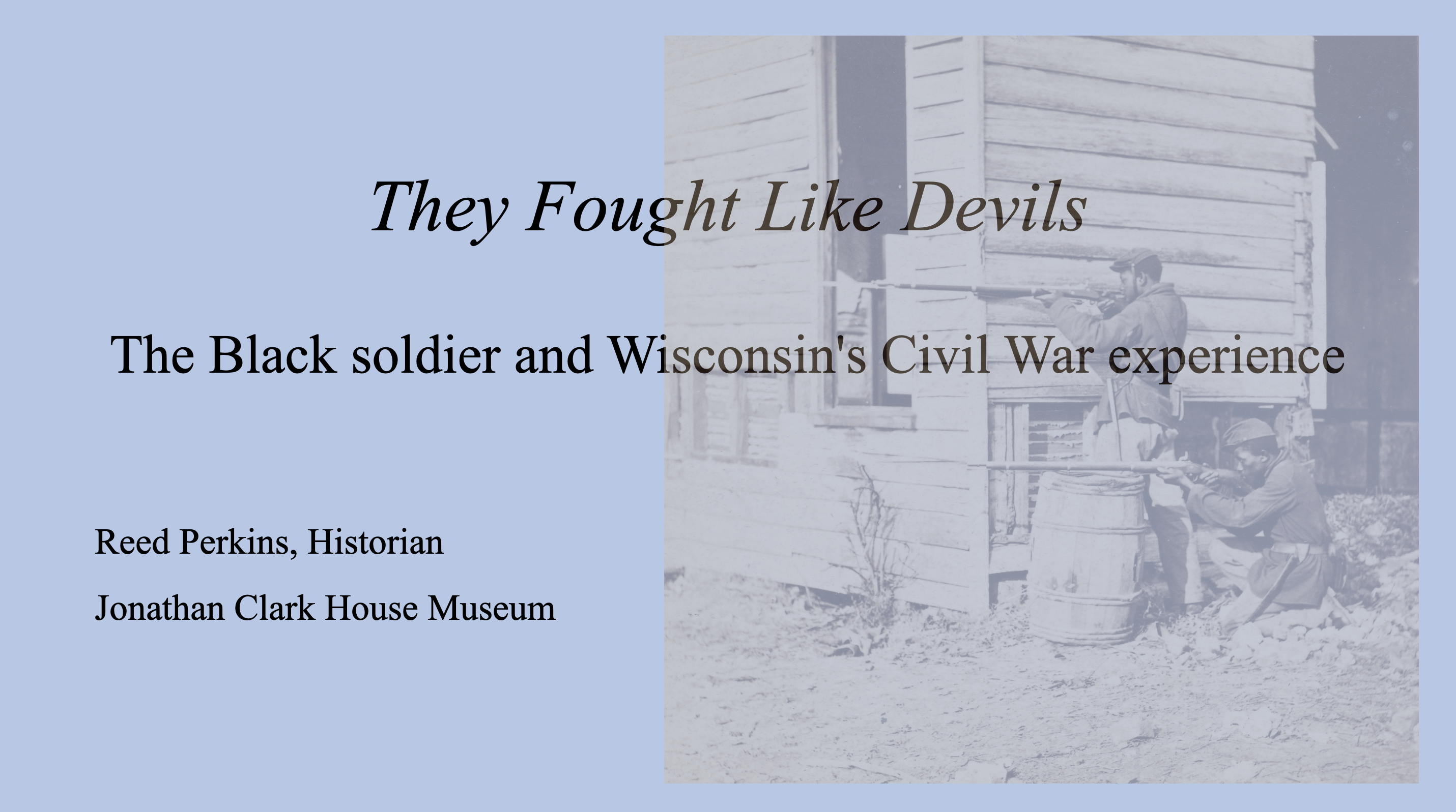
Just a reminder: I’ve been asked back to the Cedarburg History Museum to give another talk in their 2024 Civil War lecture series. My topic will be “They Fought Like Devils” – the Black soldier and Wisconsin’s Civil War experience , a multi-faceted subject that is often overlooked when discussing Wisconsin’s part in the Civil War. All are invited to the presentation at 6:00 p.m., Saturday, September 28. Seating is limited, so to attend my talk—or any of the CHM free lectures—don’t forget to RSVP to museum director Joel Willems at 262-377-5856 or joel@cedarburghm.org to reserve a place.
I know it’s been a while since my last post, but I’ve been busy! Jonathan Clark House executive director Nina Look and I just finished the latest JCH newsletter, and there’s a lot of Clark House history coming your way this fall, both here on the blog, and “live and in person.” In particular, I’m currently racing to finish not one, but two, illustrated presentations that I’ll be giving in September.
JMC, the Old Military Road, and the DAR
I’ve been asked to speak at the Fall Workshop of the Wisconsin Society, Daughters of the American Revolution. My topic will be “Building the Military Road, Wisconsin Territory’s First Federal Road.” I’ll be incorporating much of the 1830s and ’40s army and road-building information that I’ve blogged about here at CHH, as well as new primary source materials and contemporary illustrations.
The presentation will take place after dinner, Friday, September 13, at the WSDAR Fall Workshop in Oshkosh. The event is limited to registered DAR members and their guests. My thanks to Wisconsin State Regent Sandra Snow and the members of the WSDAR for their kind invitation to speak.
Advertisement, “Choppers Wanted,” Milwaukee Sentinel, August 27, 1839, page 3.
After years of searching for original reports and drawings or photographs of early Wisconsin road construction, I find myself entangled among piles of information and images on just that topic. Now, the challenge is to organize the best of this material into a few CHH blog posts and wrap up—for now—our most recent excursion along Wisconsin’s earliest roads.1
Like contractor George E. Graves in Sauk Harbor [Port Washington] in 1834 (above), I could probably use the assistance of some (digital) “axe-men” to clear my way forward. Perhaps some hearty fellows such as these…