We’ve had some snow in my corner of southeastern Wisconsin, several modest snowfalls over the past few days. I’ve had to shovel the walks and driveway at our house a few times this week, and there’s more snow—and shoveling—in the forecast. With that in mind, I thought you might enjoy the snow-related images and stories from a revised edition of this post, which originally appeared here in February, 2023.
Homer, Winslow, A Winter-Morning,—Shovelling Out, 1871. Wood engraving. Brooklyn Museum, Gift of Harvey Isbitts.
Winter chores
I empathize with the lads in this 1871 engraving by Winslow Homer. Unlike these fellows, with their (homemade?) wooden shovels, I have a lightweight, sturdy, ergonomic, plastic and metal snow shovel to work with. And although we do get snow in 21st-century Wisconsin, I haven’t had to deal with shoulder-high accumulations like the ones in Homer’s picture since I lived in western Massachusetts in the early 2010s. It looks like our 1871 snow shovelers are dealing with the kind of snowfall that Clark family neighbor Rev. James W. Woodworth described in these January, 1871, diary entries:
Hey there! We finally got some snow in southeastern Wisconsin, which prompts me to republish this essay, which originally appeared in early 2021, and has been updated and re-posted several times since. Have fun outside—or enjoy a warm beverage inside—and admire the snowy winter landscape while you can. Cheers!
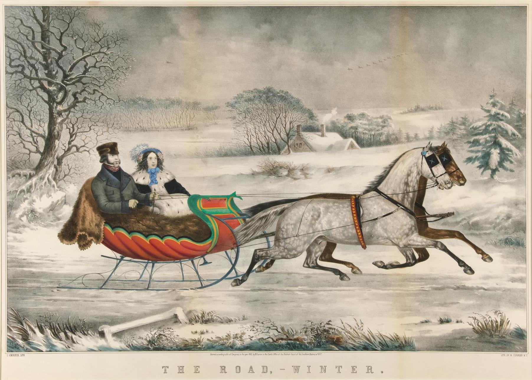
Snow, and often lots of it, was a feature of Jonathan and Mary Clark’s life in Wisconsin. And if you wanted to go to town or church or visit your neighbors during the snowy Wisconsin winter—or just enjoy a pleasant winter ride in the country—you’d need a sleigh.
Currier, Nathaniel (1813-1888), The road, winter / O. Knirsch, lith., 1853. New York: Published by Currier & Ives. Yale University Art Museum, Whitney Collections of Sporting Art, given in memory of Harry Payne Whitney (B.A. 1894) and Payne Whitney (B.A. 1898) by Francis P. Garvan (B.A. 1897) June 2, 1932. Public domain. Click to open larger image in new window.1
We don’t know if the Clarks owned a sleigh while they lived in Mequon. I suspect they did, though their sleigh—and their clothing—may not have been quite as posh as those in this Currier & Ives lithograph from 1853.
Today’s post is an updated, corrected and expanded version a post I wrote in July, 2020, outlining what we knew (at the time), about the life of Fred Beckmann, Sr., the man that occupied and farmed the Jonathan Clark farm between 1868 and 1872. Then, in early 2023, I was asked to talk about the Clark House and its Cedarburg connections at the Cedarburg History Museum. I chose to center my talk on Fred Beckmann and his extended German-American immigrant family, as I believe they exemplify a number of important themes in the transformation of Ozaukee county from the initial Anglo-American dominated first wave of local settlement in the 1830s and early ’40s, into the subsequent decades of primarily German-American settlement and development.
Anyway, I had a lot of fun, and learned a lot, in preparing that 2023 talk. And one of the things I learned is that there was some doubt about the year and date of Fred Beckmann’s death. So I recently investigated the issues and have updated images, text, and information for you about the life—and death—of Fred Beckmann, and I managed to solve at least one mystery in the process…
Saturday, March 1, 2025, from 9:00 am to Noon, the Jonathan Clark House Museum, at the corner of Bonniwell and Cedarburg Roads in Mequon, will host a special museum open house featuring an up-close exploration of our newly-acquired 1860 Plat Map of Mequon.
Remember my “Dear Santa” wish list post from last month? Well, Santa came, in the form of a cheery email with exciting historical source news from Clark House supporter, eagle-eyed historian, and all-around great friend Ellen Hickman.2
Ellen’s email, I’m happy to report, has opened new pathways to locate all kinds of otherwise hard-to-search primary and secondary historical records and documents from the Clarks’ era. Since receiving it, I’ve been chasing after documents down one formerly-obscure research “rabbit hole” after another, with some gratifying results…
Tonight is Christmas Eve, and I thought you might enjoy an expanded reprise of our 1867 Santa Claus story, originally posted in two parts, December 25 and 30, 2017. In 2021 I combined the two original posts and incorporated some new illustrations and a few revisions of the text. Here it is again, for your holiday enjoyment. Ho! Ho! Ho!
Christmas in early America
For many years now, Christmas has been celebrated by Americans as an important religious and (increasingly secular) community holiday. Christians gather to worship and commemorate the birth of Jesus, and they and other Americans enjoy a break from work to gather with family and friends to feast and exchange gifts. But it was not always this way.
In many of the American colonies, Christmas was not observed as a religious or secular holiday. The seventeenth-century Puritan leaders of the Massachusetts Bay Colony considered Christmas to be non-biblical and pagan influenced. In Boston and other parts of New England any observance of Christmas was prohibited and, for a few years, actually illegal:
Penalty for Keeping Christmas, 1659
Records of the Governor and Company of the Massachusetts Bay in New England. Printed by order of the Legislature, edited by Nathaniel B. Shurtleff, M.D., Vol. IV, Part I, 1650-1660, online at mass.gov (accessed 21 Dec. 2021). Click to open larger image in new window.
Transcription: For preventing disorders arising in several places within this jurisdiction, by reason of some still observing such festivals as were superstitiously kept in other countries, to the great dishonor of God and offence of others, it is therefore ordered by this Court and the authority thereof, that whosoever shall be found observing any such day as Christmas or the like, either by forbearing of labor, feasting, or any other way, upon such accounts as aforesaid, every such person so offending shall pay for every such offence five shillings, as a fine to the country.
Christmas was not generally accepted as a holiday in many parts of the United States until after the federal government made December 25 a national holiday in 1870.
On the other hand…
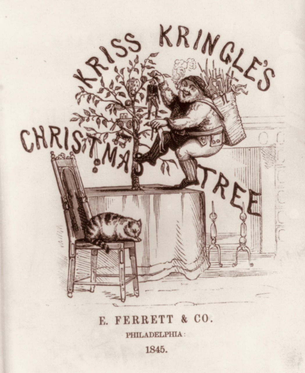
The Massachusetts Puritans may not have approved of “observing any such day as Christmas or the like, either by forbearing of labor, feasting, or any other way,” but Christmas was “kept in other countries” and increasing numbers of immigrants from those countries to the United States—particularly from Victorian England, Catholic Europe, and the German Lands—celebrated the day in their new American homes with many of their accustomed religious observances and national traditions.
KrissKringle’s Christmas Tree [title page], E. Ferrett & Co., Philadelphia, 1845. Library of Congress
I grew up in the Chicago suburbs, and I remember the holiday thrill of riding the Chicago & Northwestern commuter train downtown with my parents, and then walking into the majestic State Street headquarters of Chicago’s grandest department store, Marshall Field & Company. Our mission? A trip up to the “toy floor” at Field’s, where we would wait in line to tell Santa all the wonderful things we would like to receive for Christmas that year.1
It goes without saying that I haven’t been able to fit on Santa’s lap for a very long time. But as the Clark House Historian, I still have holiday dreams and wishes, and today I’d like to share some of them with you. Who knows, perhaps Santa will work his magic once again?
(Official disclaimer: I do not serve on the JCH Board of Directors, or any of its committees. This is my Christmas daydream, a fantasy of what I’d like to see unfold at my favorite museum, given unlimited resources. And besides, as the great Chicago architect and city planner Daniel Burnham famously said: “Make no little plans. They have no magic to stir men’s blood!”)
My list is organized into several parts, the first of these is…
Veterans Day is today. For a perspective on the day—and our early Mequon veterans—here’s a post originally published at Clark House Historian on November 11, 2016, and revised, expanded and republished several times since. These stories, by the way, are not the only stories of local veterans that I have collected. My recent research has discovered some amazing stories of German immigrant and Black American soldiers that fought for the Union—and Ozaukee county—as part of Wisconsin’s Civil War experience. And I still have much to learn about the Civil War service of Mary Clark’s brother, Benjamin Turck and the post-war travails of Persie Clark’s husband, the war-wounded U.S. Navy veteran and pensioner Henry D. Gardner. I hope to tell those stories here, at Clark House Historian, in the near future.
Armistice Day
One hundred and six years ago, on the eleventh day, of the eleventh month, at the eleventh hour—Paris time—the Armistice of Compiègne took effect, officially ending the fighting on the Western Front and marking the end of World War I, the optimistically named “War to End All Wars.”
In the United States, the commemoration of the war dead and the Allied victory began in 1919 as Armistice Day, by proclamation of President Woodrow Wilson. Congress created Armistice Day as a legal holiday in 1938. Starting in 1945, a World War II veteran named Raymond Weeks proposed that the commemorations of November 11 be expanded to celebrate all veterans, living and dead. In 1954 Congress and President Eisenhower made that idea official, and this is what we commemorate today. There are many veterans with a connection to the Jonathan Clark house. We honor a few of them in this post.
Jonathan Clark, Henry Clark, and the U.S. Army
Jonathan M. Clark (1812-1857) enlisted as a Private in Company K, Fifth Regiment of the U. S. Army, and served at Ft. Howard, Michigan (later Wisconsin) Territory, from 1833 until mustering out, as Sargent Jonathan M. Clark, in 1836. In the 1830s, Fort Howard was on the nation’s northwestern frontier. Jonathan’s Co. K spent much of the summers of 1835 and 1836 cutting the military road across Wisconsin, from Ft. Howard toward Ft. Winnebago, near modern Portage, Wisconsin.
Fort Howard, Wisconsin Territory, circa 1855, from Marryat, Frederick, and State Historical Society Of Wisconsin. “An English officer’s description of Wisconsin in 1837.” Madison: Democrat Printing Company, State Printers, 1898. Library of Congress. Click to open larger image in new window.
Join us at the Cedarburg History Museum this Saturday!
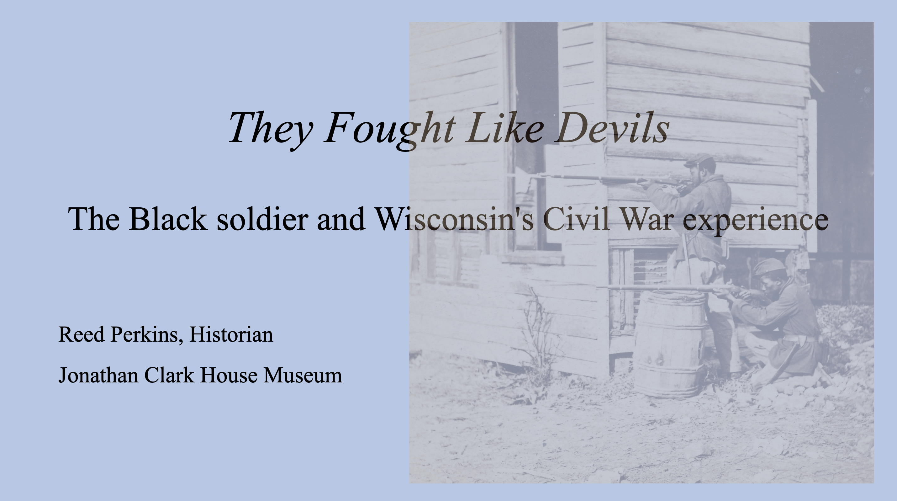
Just a reminder: I’ve been asked back to the Cedarburg History Museum to give another talk in their 2024 Civil War lecture series. My topic will be “They Fought Like Devils” – the Black soldier and Wisconsin’s Civil War experience , a multi-faceted subject that is often overlooked when discussing Wisconsin’s part in the Civil War. All are invited to the presentation at 6:00 p.m., Saturday, September 28. Seating is limited, so to attend my talk—or any of the CHM free lectures—don’t forget to RSVP to museum director Joel Willems at 262-377-5856 or joel@cedarburghm.org to reserve a place.
Today is Labor Day, the holiday celebrating the working men and women of our nation, and I thought I’d commemorate the day with a lightly-revised re-post of this piece from 2023.
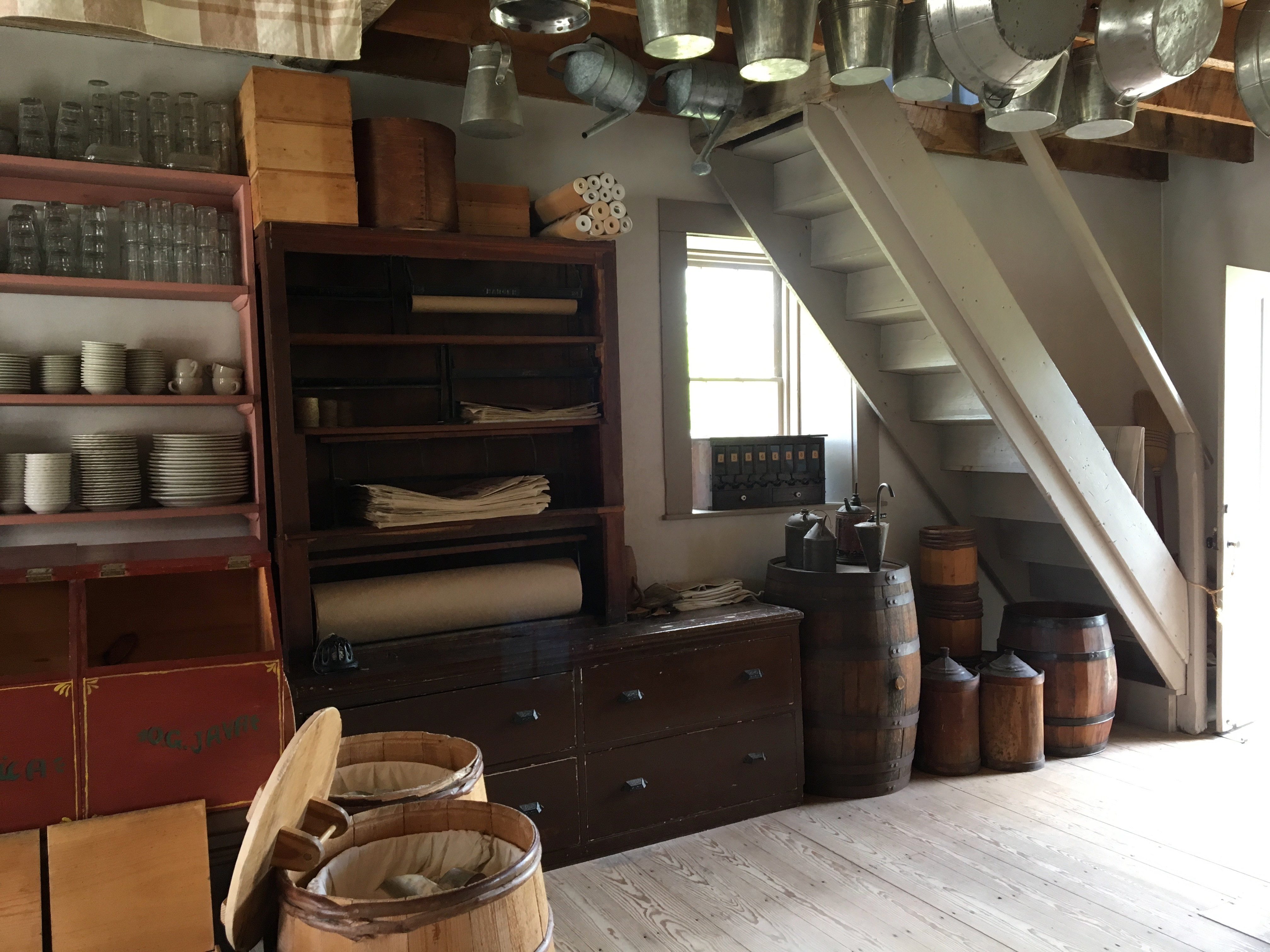
This Labor Day, I’ll be at home, working on my upcoming lectures for the state DAR and the Cedarburg History Museum. Last year, I had to work at our local mercantile establishment. You know, a store kind of like this one, only much bigger, stocked with just about anything you need for modern living:
I don’t really have the day “off” today—too much writing to do—and won’t be marching in a parade, but I’d still like to honor the holiday and salute the American worker, past and present. With that in mind, let’s revisit some of the nineteenth-century occupations we’ve talked about previously at Clark House Historian, highlighting a few of the many skills, trades, and occupations common during the Clark House era.
Since it is a holiday, I’m not going to add long commentaries to each photo. Enjoy the photo galleries, and click each gallery to open larger versions of each image. And click the highlighted links to visit the original CHH posts, filled with lots more information about the different skills, tools, and jobs, and the full image credits.