UPDATED, February 11, 2024, to include a revised annotated map. But for the full update—with additional notes and corrections—please see the most recent version of this, posted on February 12, 2024.
As a kind of postscript to our look at the early Wisconsin territorial, state and federal censuses, today’s Monday: Map Day! revisits an interesting map that we first discussed on October 29, 2017. Today’s post includes a few updates and corrections based on new information.
It’s 1836. Where’s…Wisconsin?
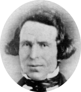
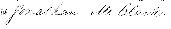
In September, 1836, Sgt. Jonathan M. Clark was discharged from the U.S. Army at “Camp Hamilton,” Wisconsin Territory. after serving his three-year term of service with Co. K, Fifth Regiment of Infantry.1 One year later, in the autumn of 1837, Jonathan’s future wife Mary Turck would make the long trip from Palmyra, New York, to Milwaukee and finally Mequon, Washington County, Wisconsin, with her parents Peter and Rachael Turck and six younger siblings. By the end of 1840 Jonathan and Mary would be married and starting their family in Mequon.
That seems simple enough, until you take a moment to wonder how much Jonathan—or especially Mary and her family—knew about this new Wisconsin Territory. Jonathan had been in the territory since October, 1833, mostly on post at Ft. Howard. In the last year or so of his service he was busy cutting trees and building bridges for the military road along the Fox River waterway from Ft. Howard (Green Bay) towards Ft. Winnebago (near modern Portage). As a road-building soldier, Jonathan might have done some surveying and seen—or helped draw—a variety of maps of the military road and its vicinity. But for a better overview of this new territory, Jonathan or Mary might have sought out a map such as this2:
Continue reading