I’m working on a subject suggested by my friends Sam Cutler and Bob Blazich from the Mequon-Thiensville Historical Society. Among other projects over the last few decades, they and their colleagues at the MTHS have restored what is believed to be Ozaukee county’s oldest building on its original foundation, the historic Isham Day house, and developed its interior into the Mequon River Postal Museum. Now my friends at the MTHS want to know more about the life of Mequon River Post Office’s original postmaster, one of Mequon’s very first pioneer settlers, John Weston.
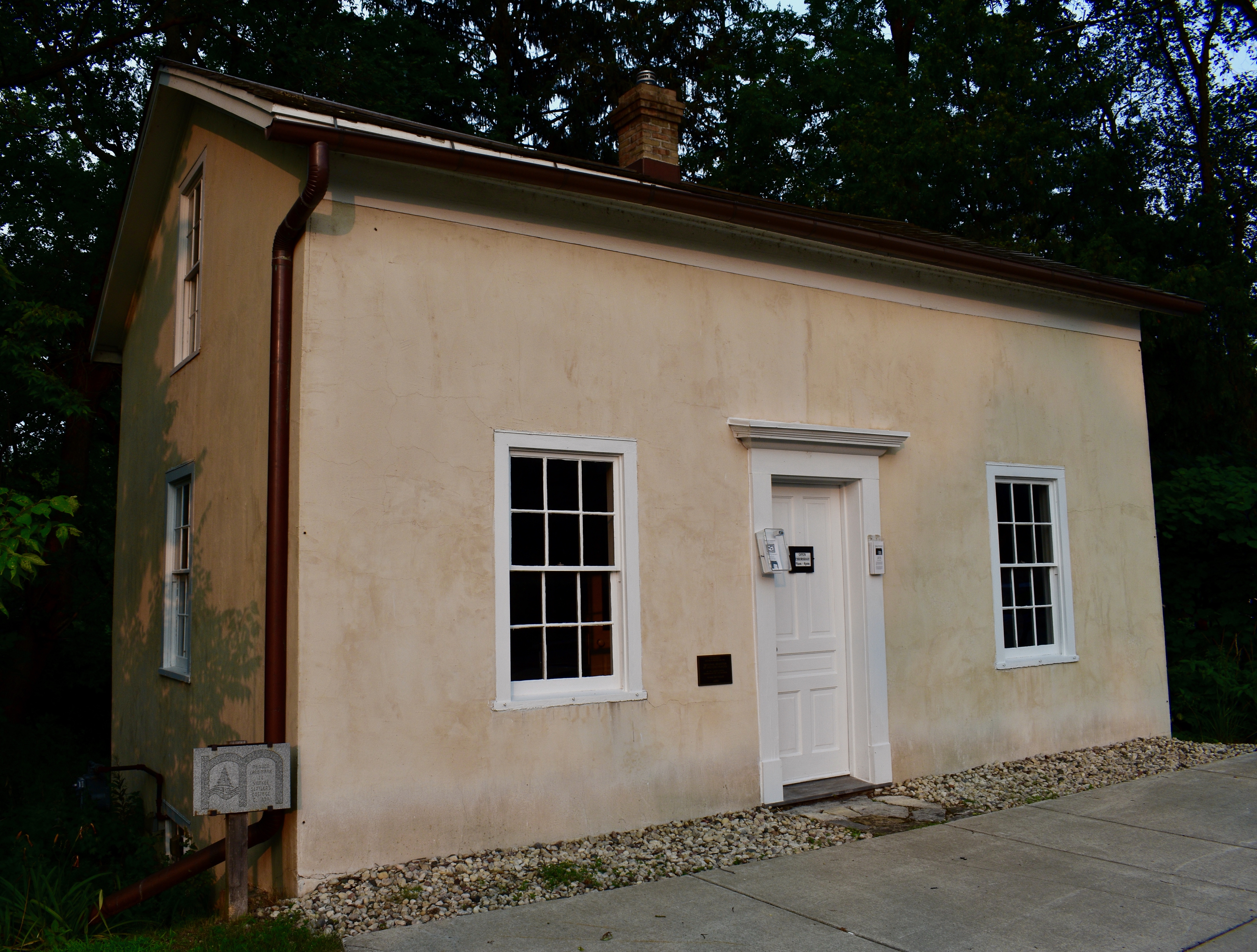
Isham Day house, exterior, west front. Photo credit: Anna Perkins, 2021
So for the last several weeks I’ve been doing a great deal of behind-the-scenes reading and re-reading of primary and secondary sources, as well as a lot of searching for additional relevant documents, including early Milwaukee and Washington/Ozaukee county deeds and other land records. In the process, I’m learning a lot about John Weston, Isham Day, Henry Thien, and some of our other first white settlers. But I’m not quite ready to write a John Weston profile, and I still need to clear up some mysteries about Isham Day’s land and house, too.
First Postmaster(s)

New post office…at Mequan River…John Weston appointed postmaster, Milwaukee Advertiser, Oct. 10, 1840, page 2
Let’s get our bearings by making an accurate list of the county’s first postmasters and their terms of office. Our source is from the National Archives in Washington, DC, the Record of Appointment of Postmasters, 1832-Sept. 30, 1971; Records of the Post Office Department; Record Group Number: 28; Series: M841; Roll Number: 144. County: Polk – Wood, Vol. 12B, circa 1832-1844, pages 794-795, currently available via Ancestry.com as U.S., Appointments of U. S. Postmasters, 1832-1971 [database on-line], 2010, image 428 of 583 (accessed 18 Jan 2024). Here’s the microfilmed image of the two-page ledger recording Washington county’s first post offices and postmasters, slightly retouched to make for easier reading:

Click the image for a higher-resolution view, and then read on for more details about old Washington/Ozaukee county’s first two post offices and their original postmasters.
Continue reading