Just a reminder…
248 years ago today, representatives of all thirteen of Britain’s American colonies, gathered “in congress” in Philadelphia, and publicly declared our independence from “George the Third, by the Grace of God, King of Great Britain, France, and Ireland, Defender of the Faith, and so forth,” and his distant and unresponsive legislature. The Americans proposed to separate—forever—from their Divinely appointed King, and form a new and independent nation, the “united States of America.” This decision was bold, completely unprecedented in a world dominated by autocratic monarchs, and potentially fatal for anyone that supported this Declaration of Independence. From the King’s point of view, the authors, his subjects, were committing treason.

After a public reading of the Declaration of Independence at Bowling Green, on July 9, 1776, New Yorkers pulled down the statue of King George III.
The authors of the Declaration were clear-eyed about the stakes, yet unwavering in their desire to separate from the King. They closed their—our—Declaration of Independence with their unanimous avowal that, […] for the support of this Declaration, with a firm reliance on the protection of divine Providence, we mutually pledge to each other our Lives, our Fortunes and our sacred Honor.
The Declaration of Independence is our pivotal foundational document. People risked their lives and fortunes by creating and signing it. Thousands of Patriots died in the subsequent War of Independence in order to make the “united States of America” a reality. A large number of British-Americans, still loyal to their monarch, fled the 13 colonies and migrated to the King’s remaining possessions to the north, including Nova Scotia and the Province of Quebec.
Through it all, the ideals expressed in the Declaration inspired generation after generation of Americans, including Jonathan Clark and his ancestors, as attested in this excerpt from daughter Caroline (Clark) Woodward’s 1893 biographical sketch:
[…] Jonathan M. Clark, was a Vermonter of English descent, who, born in 1812, of Revolutionary parentage, inherited an intense American patriotism.
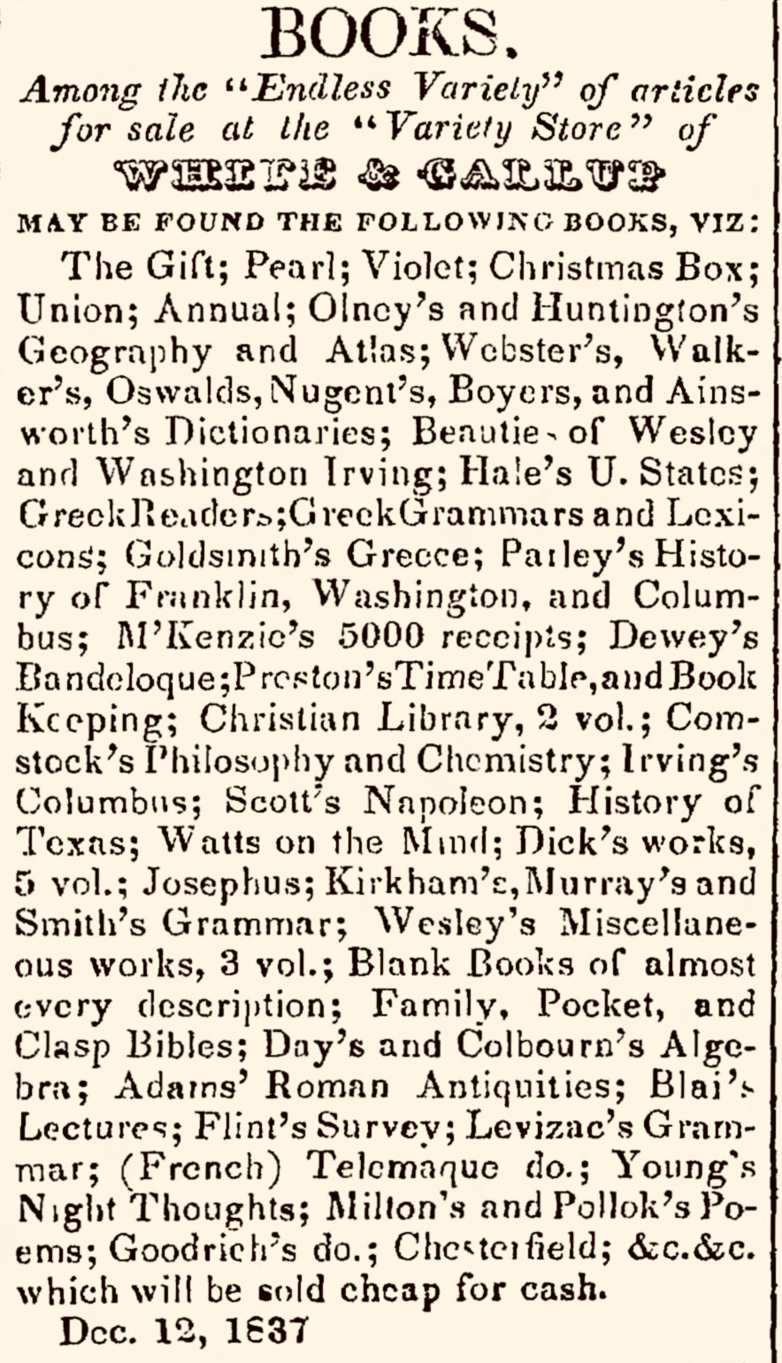
Jonathan Clark and his Mequon neighbors—including native-born “Americans,” as well as more recent immigrants from Ireland, the German lands, the United Kingdom, Nova Scotia, and elsewhere—knew the Declaration, read it aloud at patriotic events (in English and German!), and shared its anti-monarchical sentiments.
This July 4th, before you head to the beach or light the barbecue, why not refresh your memory and read the document that created our nation, and forever declared our freedom from the “absolute Despotism” of kings?
In Congress, July 4, 1776.
The unanimous Declaration of the thirteen united States of America,
When in the Course of human events, it becomes necessary for one people to dissolve the political bands which have connected them with another, and to assume among the powers of the earth, the separate and equal station to which the Laws of Nature and of Nature’s God entitle them, a decent respect to the opinions of mankind requires that they should declare the causes which impel them to the separation.
Continue reading