I’m still reading and transcribing the various “Returns of Persons names who have taken the Oaths” that I’ve found (so far) among the Land Petitions of Lower Canada, 1764-1841. The list-making has been slow going, and nothing is quite ready for posting.
So while you’re waiting for the next installment of our “Searching for JMC’s roots” investigation, I thought you might enjoy this autumnal, hand-colored lithograph of Lake Memphremagog, looking westward across the lake from the shoreline of the northwest part of Stanstead Township—or possibly southwest Hatley Township— toward the mountain known as the Owl’s Head in Potton Township.
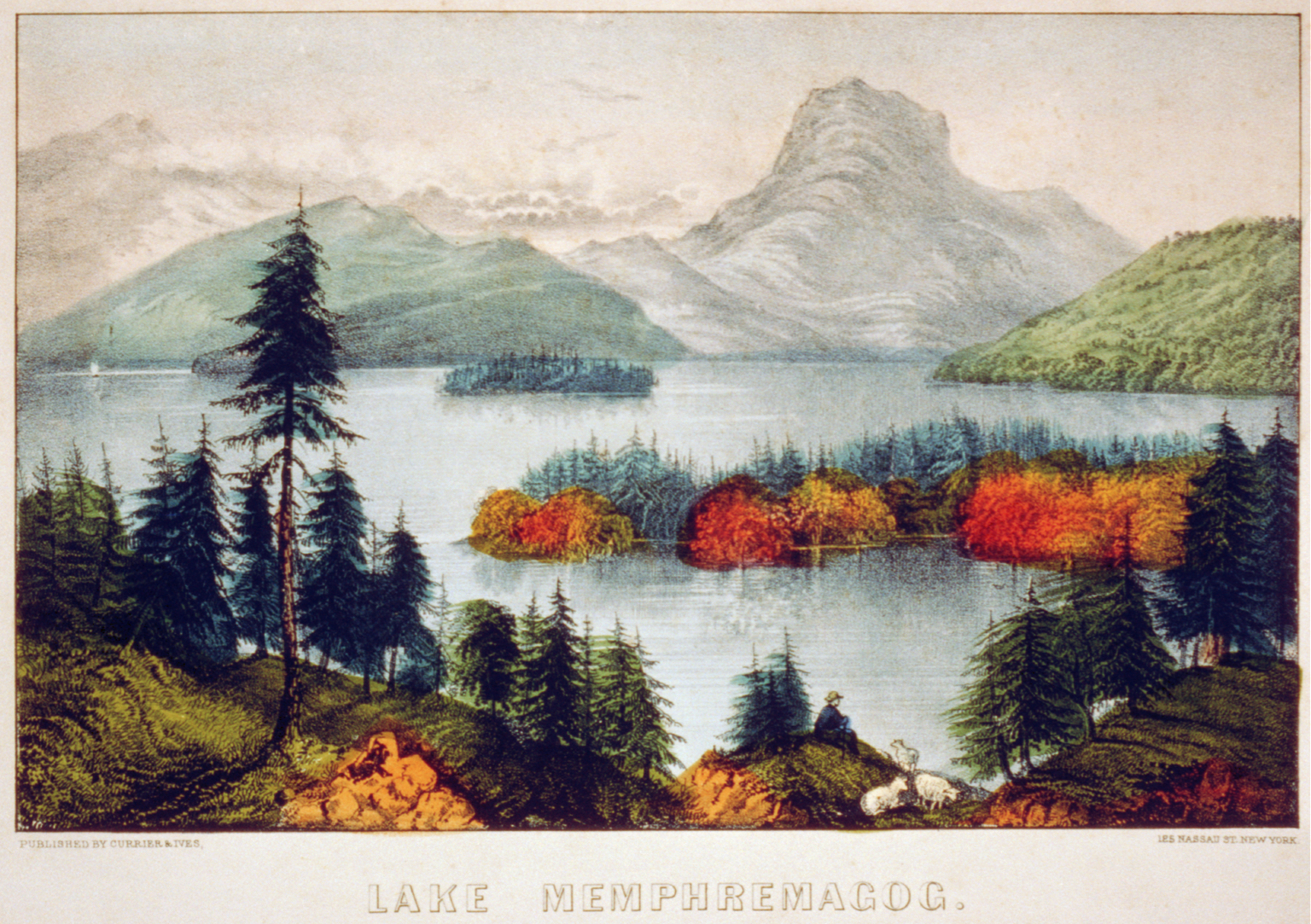
Today’s image is another hand-tinted lithograph by Currier & Ives, entitled Lake Memphremagog–Owls Head. [New York: published by Currier & Ives, c. 1840-1880], from the collection of the Library of Congress. As always, for the best view click on the image to open a larger, higher-resolution copy of the picture in a new, zoomable window.
Chances are that Jonathan Clark—or his parents or other kin—may have enjoyed a similar view from along the shores of Lake Memphremagog during the early days of white settlement in Stanstead Township, Lower Canada, and adjacent Orleans County, Vermont. And from what I can tell, it’s still a scenic part of the world, even if the Owl’s Head has become a four-season resort (en français), featuring skiing and other snow sports in the winter and golf in the summer.
I’ll be back soon with more Clark House History. See you then.

Fred and I were in Orleans county, but I do not think we saw this lake. Very nice painting.
Nina
LikeLike
I’m glad you liked the lithograph. I do too.
I haven’t had the pleasure of visiting the area, but from what I can tell this view of Lake Memphremagog was probably made from somewhere around the Ogden, Stanstead township, Québec area, looking west across the lake toward the Owl’s Head mountain.
The Ogden area is about 6 miles north of Derby Line, Orleans county, Vermont. And if you want to visit the lake shore in Vermont, you’ll have to go about 6 miles due west from Derby Line for a view. The terrain between Derby Line and the lake appears to be hilly enough that you’d need to get pretty close to be able to see the lake.
LikeLike